Strange Maps
A special series by Frank Jacobs.
Frank has been writing about strange maps since 2006, published a book on the subject in 2009 and joined Big Think in 2010. Readers send in new material daily, and he keeps bumping in to cartography that is delightfully obscure, amazingly beautiful, shockingly partisan, and more. "Each map tells a story, but the stories told by your standard atlas for school or reference are limited and literal: they show only the most practical side of the world, its geography and its political divisions. Strange Maps aims to collect and comment on maps that do everything but that - maps that show the world from a different angle."
featured


All Stories

Big nations or small ones: each gets a same-sized square on this map
“This work uses real statistics on Austria to create an image of Austria,” Babak Fakhamzadeh here on his website about this work, ‘Numbers’, that he created for Paraflows in Vienna, demonstrating […]
n British-born sculptor Tony Cragg (°1949, Liverpool) left his native land in 1977 to work on the Continent. He now resides in Wuppertal, Germany. This work, entitled ‘Britain Seen From […]
n In Great Britain as in the US, two cultural sub-nations identify themselves (and the other) as North and South. The US’s North and South are quite clearly delineated, by […]
For a brief window of time after the fall of communism, it really seemed that the world was at the ‘end of history‘. That phrase was coined by Francis Fukuyama, […]
n “Looks tasty, doesn’t it”, says one of the submitters of this map made out of Spam. Well, that’s a matter of opinion (but I think he was being ironic, […]
I have to agree with Brandon Keim, who reviewed this map for Wired Magazine (here): it most definitely is one of “the coolest planetary maps ever”. This map is of […]
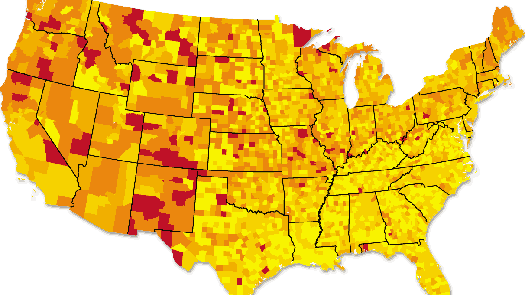
The J. Allen Hynek Center for UFO Studies from Chicago published this strange map of UFO reports per 100,000 people by county in the continental US.
“This map is basically what would happen if you got a bunch of Japanese guys in a room, got them drunk, and then asked them to draw what they could […]
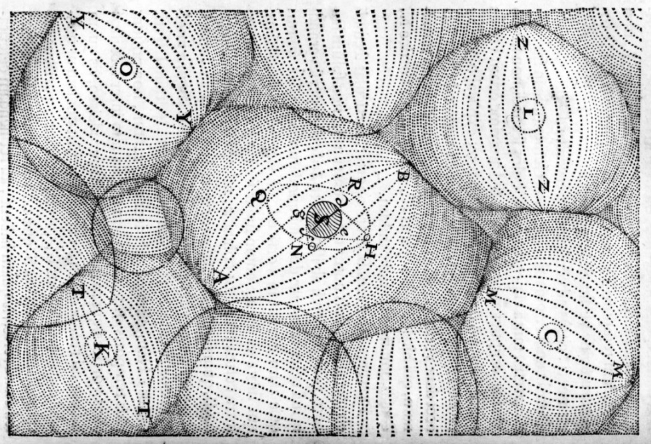
n Christa Dichgans (°1940 in Berlin) is a German painter who has shown a proclivity towards cartography in her work. Generally, her map paintings consist of a monochrome background surmounted […]
The world can be sliced and diced in many ways, and one of them is by dividing it into the 245 ccTLDs that cover every country and territory in the […]
An amazing feat of engineering, but at the cost of much blood and treasure

Scientists predict the Earth will end 5 billion years from now, when the Sun becomes a red giant. Certain religious people are more alarmist, claiming the Apocalypse is just around the corner.
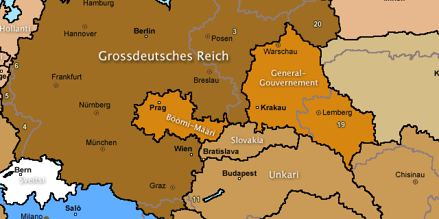
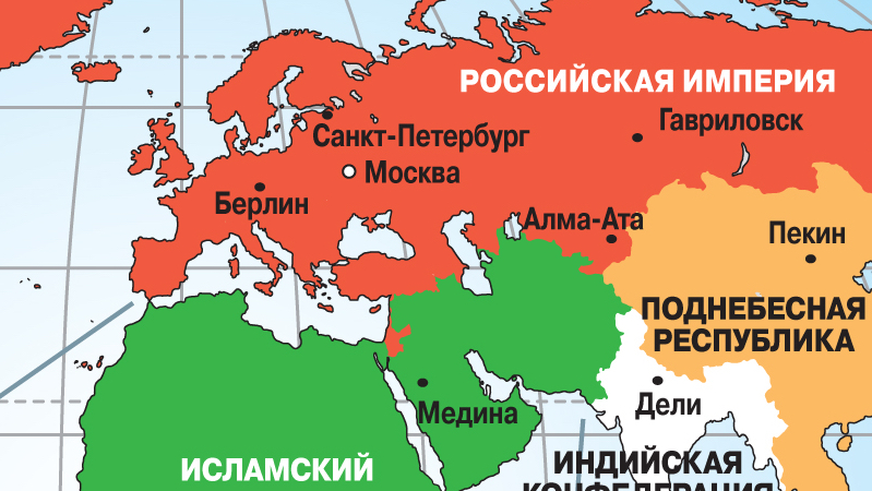
One of the mainstays of speculative history (together with “What if the South had won the US Civil War?”) is: What would the world have looked like if the Nazis […]
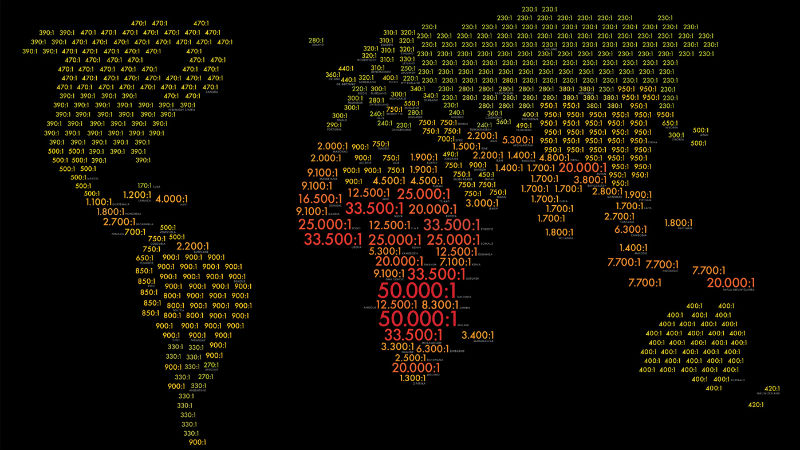
Remarkably, Cuba leads the world (or at least those countries shown on this map) in the patients per doctor ratio.
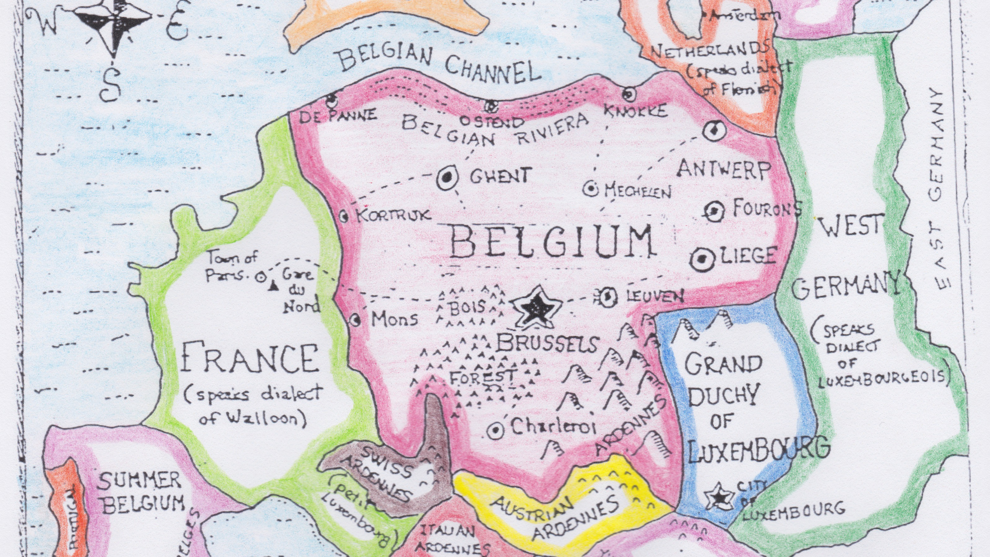
Europe shocked as leaked map reveals secret plan for Belgian domination
n It’s more than three months now since Belgium held a general election, and the federal kingdom by the North Sea is still without a national government. The impasse following […]
n A gallant piper, stuggling through the bogs,nHis wind bag broken, wearing his clay clogs;nYet, strong of heart, a fitting emblem makesnFor Scotland – land of heroes and of cakes. […]
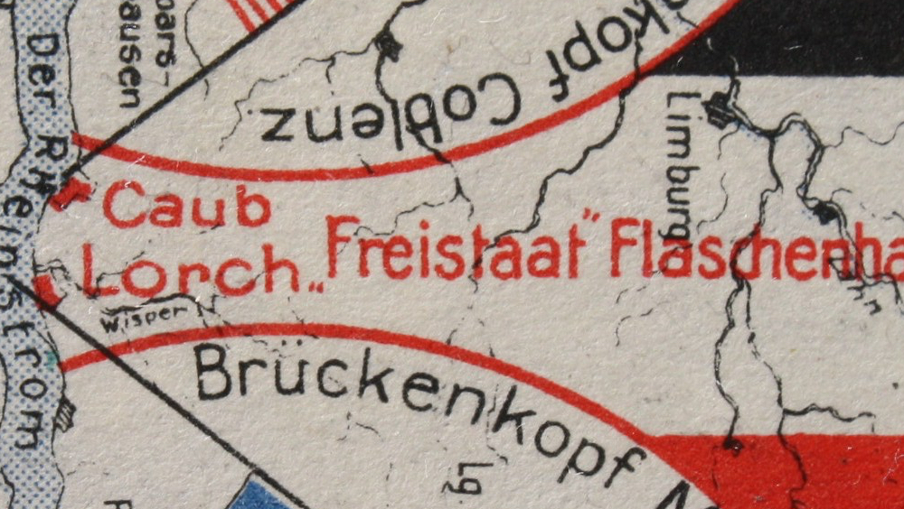
Squeezed in between two occupation zones, the locals opted for independence – and smuggling.

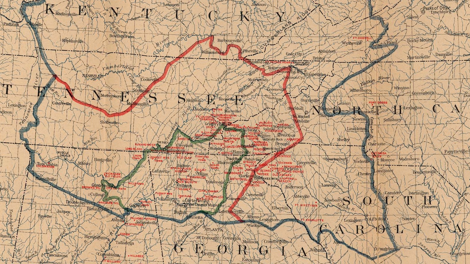
Meet Kentucky’s western exclave, courtesy of the Mississippi
Almost ten years after its first publication, are the predictions in this book any closer to coming true?
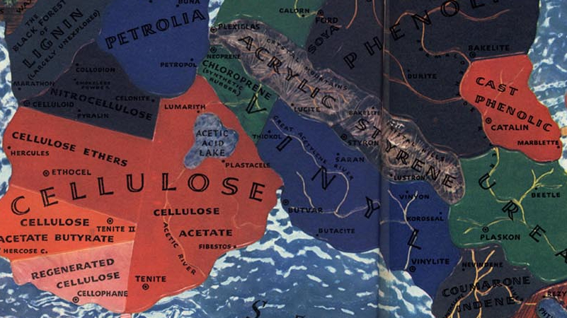
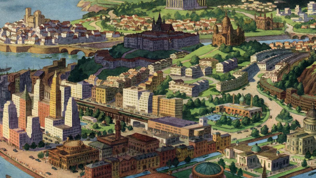
A 1940 map of a fictional continent slightly resembling South America, symbolising different aspects of the new and exciting world of plastics
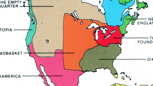
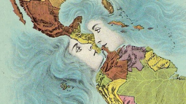
Forget about the United States of America, forget about Canada and about Mexico. North America might be divided into these three states, but the northern half of the American continent […]
The series of tubes famously dubbed the ‘internets’ by president G.W. Bush* constitute a world wide web of interconnectedness. But, as this map demonstrates, there are some black holes in […]
At 678.051 km² (261.797 sq. mi), Texas is the largest of the 48 contiguous states. With a population of over 23 million, it’s also the second most populous, after California. […]
When historians look back on the current conflict in Iraq, they might very well call it the Third Gulf War. The first one would have been the Iran-Iraq War (1980-1988), […]
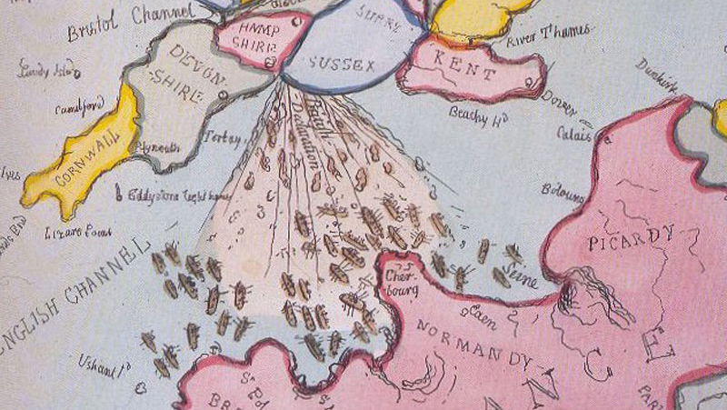
Brexit lends a renewed poignancy to Gillray’s scatological cartoon