Strange Maps
A special series by Frank Jacobs.
Frank has been writing about strange maps since 2006, published a book on the subject in 2009 and joined Big Think in 2010. Readers send in new material daily, and he keeps bumping in to cartography that is delightfully obscure, amazingly beautiful, shockingly partisan, and more. "Each map tells a story, but the stories told by your standard atlas for school or reference are limited and literal: they show only the most practical side of the world, its geography and its political divisions. Strange Maps aims to collect and comment on maps that do everything but that - maps that show the world from a different angle."
featured


All Stories
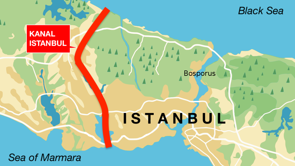
‘Kanal Istanbul’ would create a second Bosporus – and immortalize its creator.

Two Williams pioneered geological mapping in Britain and the United States – but the world only remembers one.
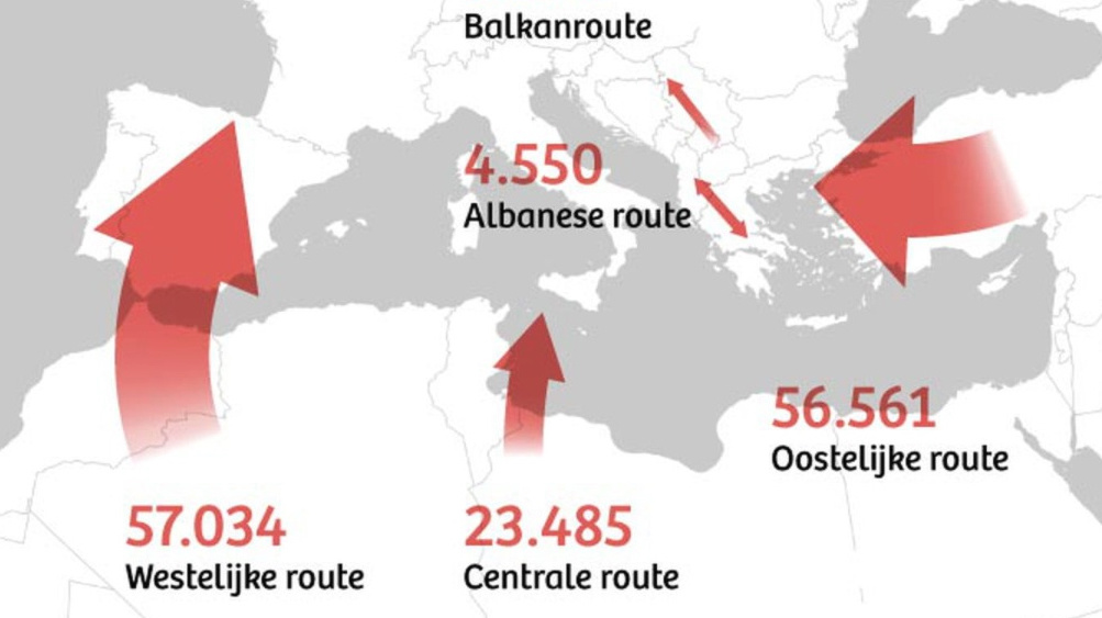
‘Battlefield maps’ show continent under attack from hostile invaders.
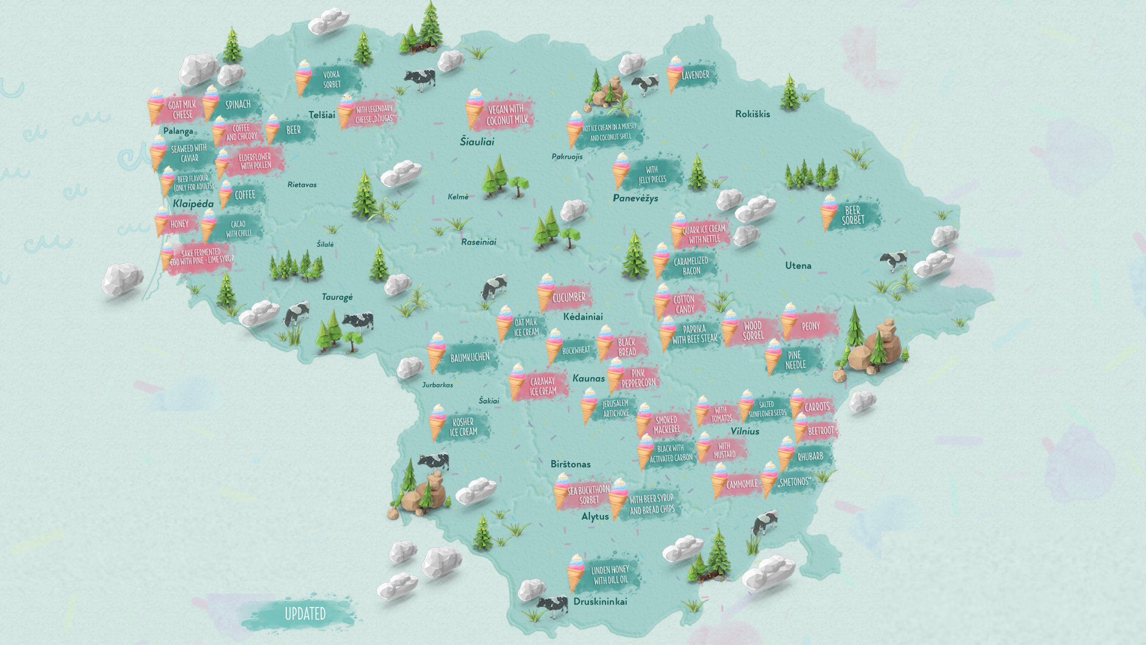
The Baltic nation rolls out an unlikely tourist attraction: 47 weird ice cream flavors.
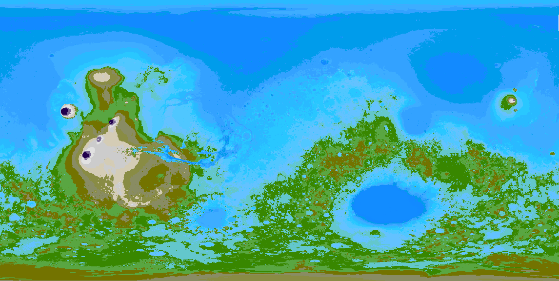
A 71% wet Mars would have two major land masses and one giant ‘Medimartian Sea.’

Maps show the oldest company in (nearly) every country – and a few interesting corporate trends.
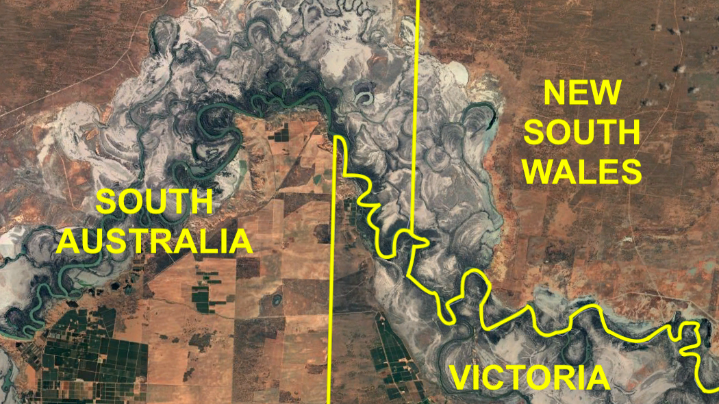
Victorians want to rectify 19th-century surveying error – and become South Australians.
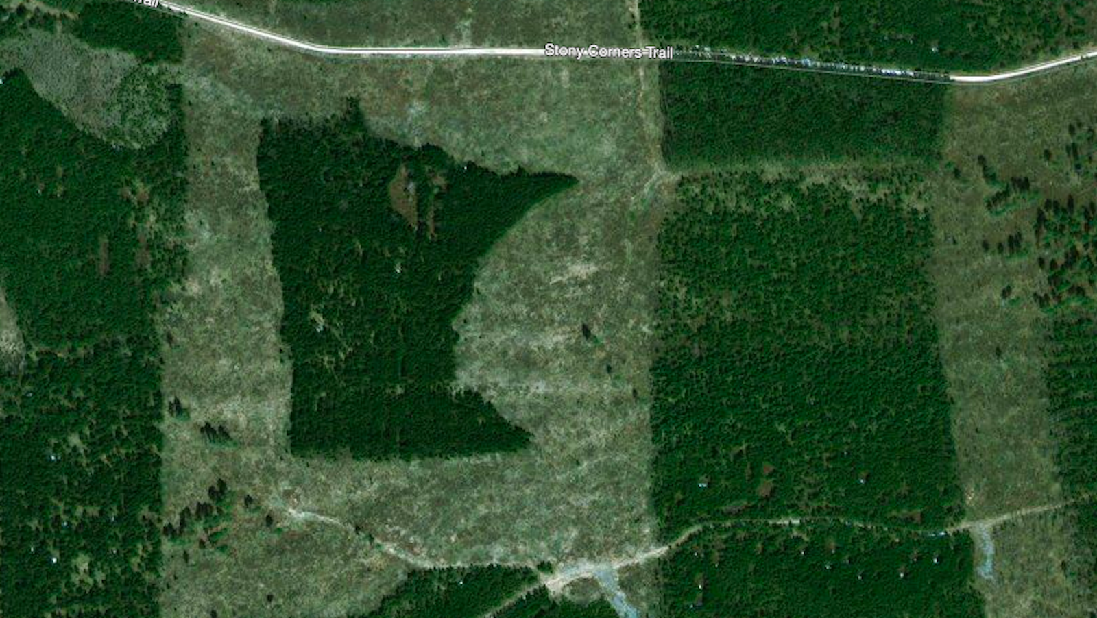
Some intriguing examples of people grooming the land for the unseen observer above.
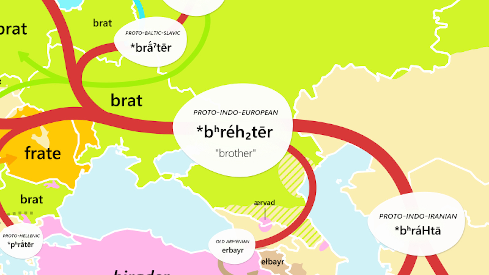
Two remarkable etymological maps show twin forces at work throughout human history.
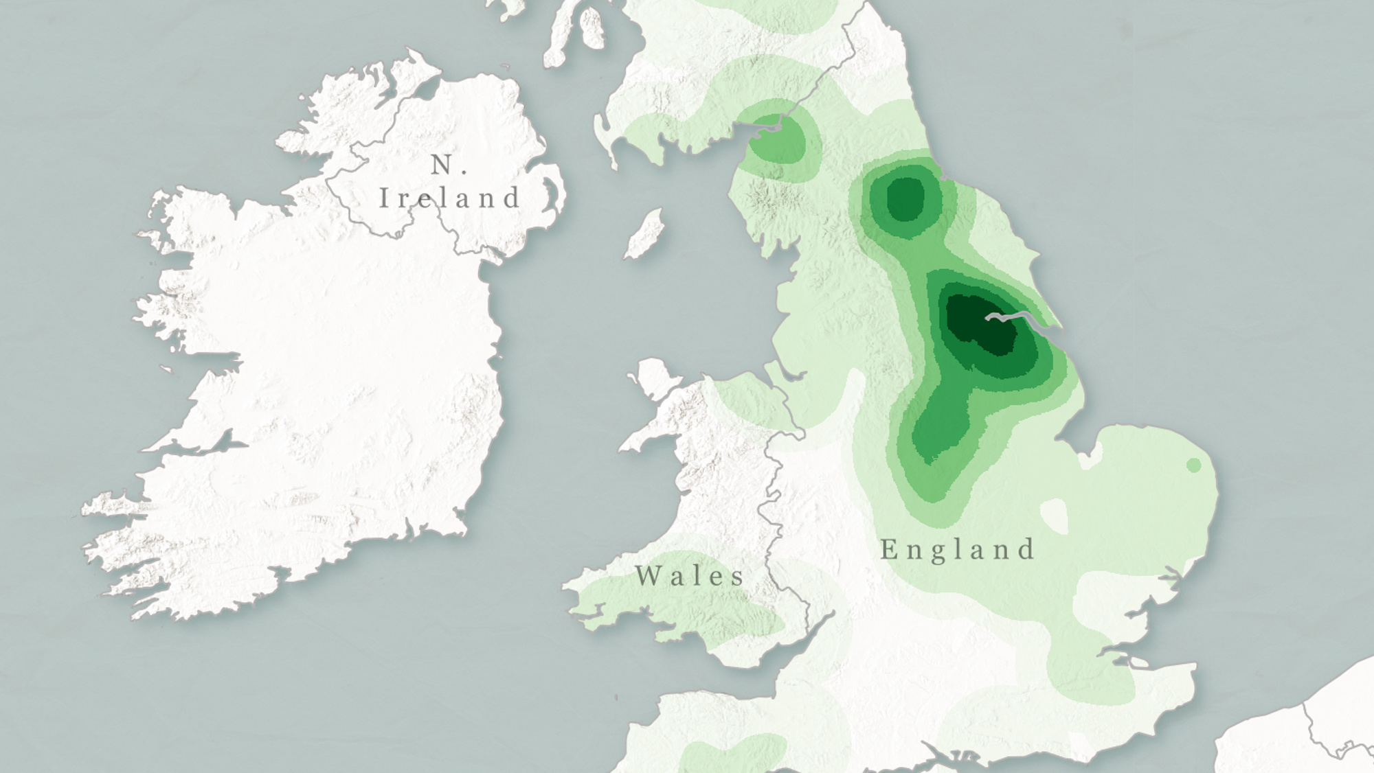
Mapping the frequency of common toponyms opens window on Britain’s ‘deep history’.
Iranian Tolkien scholar finds intriguing parallels between subcontinental geography and famous map of Middle-earth.
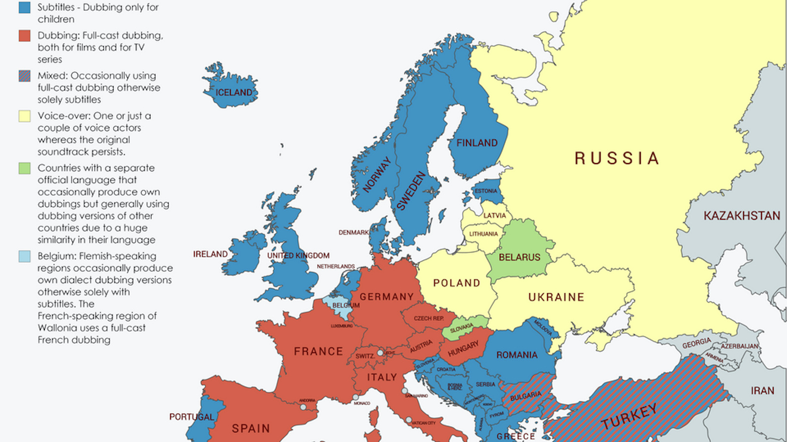
Europe is divided on whether films should have subtitles or different audio tracks.
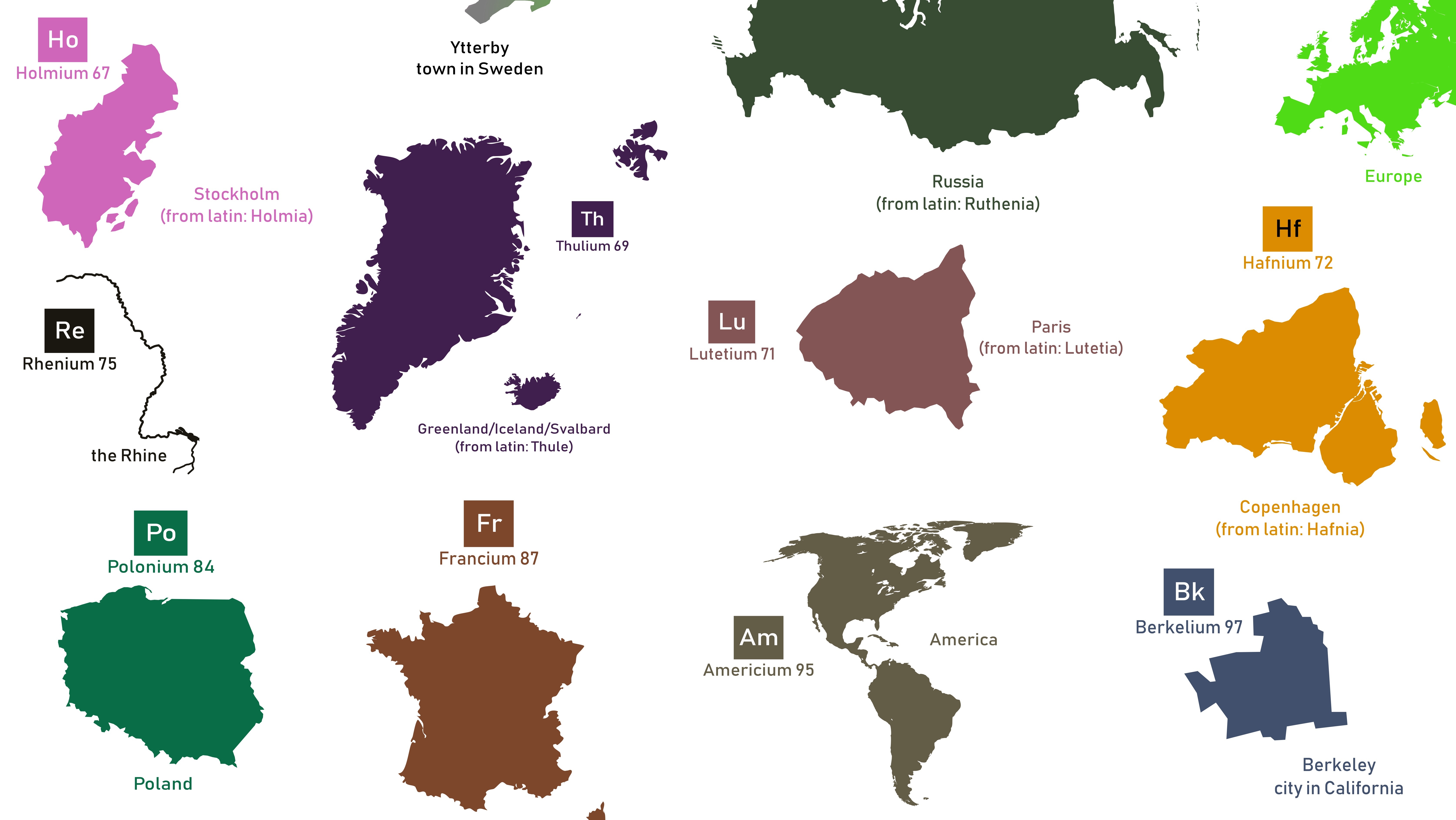
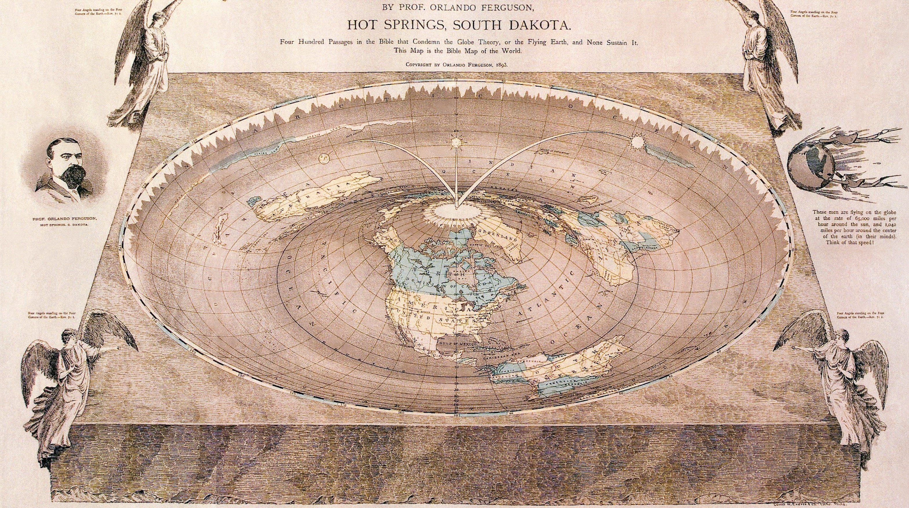
Can’t memorize all those elements? If you’re more into geography, perhaps this will help.
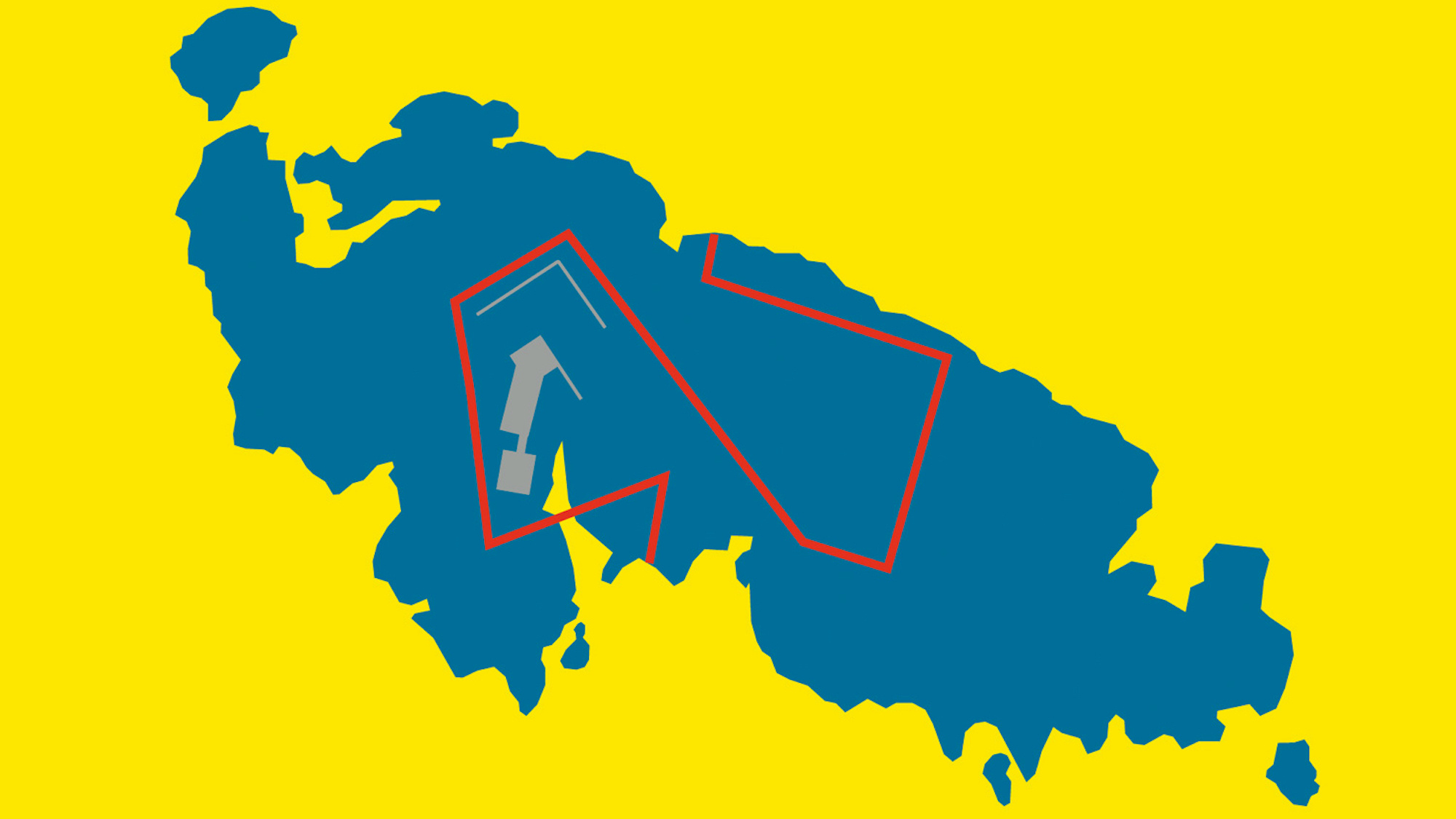
New book focuses on some of the world’s most peculiar borderlines.
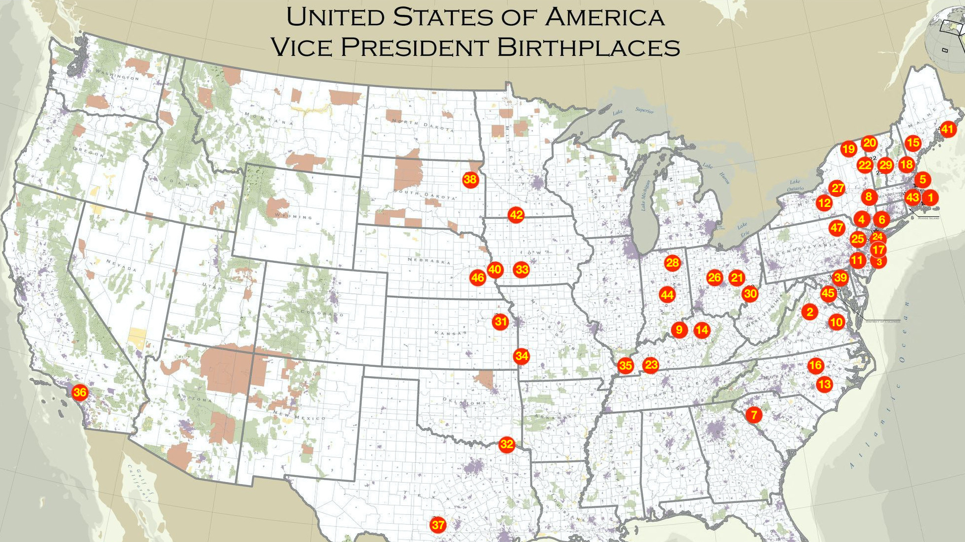
Trump is #45 but Pence is #48 – and other strange consequences of the curious office of vice president.
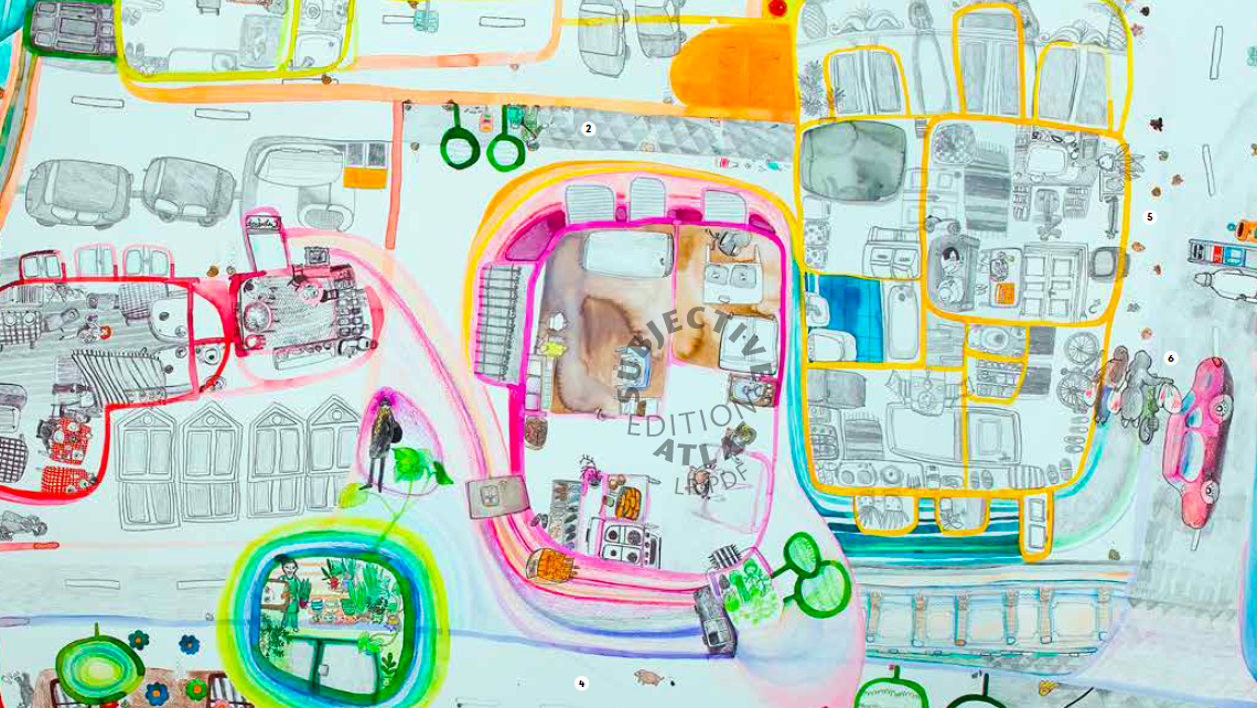
To get a sense of faraway places, these ‘atlases’ let the locals give you their perspective.
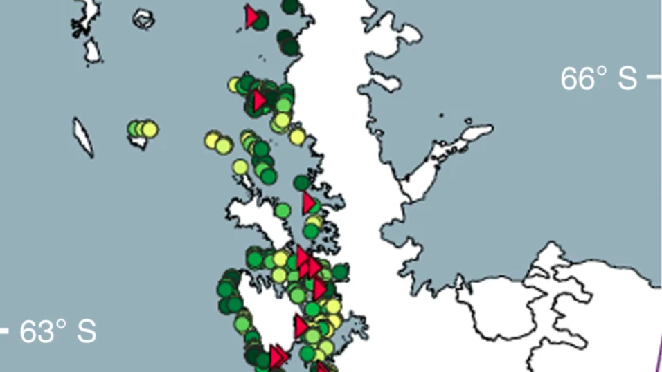
Penguin poop and climate change are fuelling the spread of ‘snow algae’ down the Antarctic Peninsula
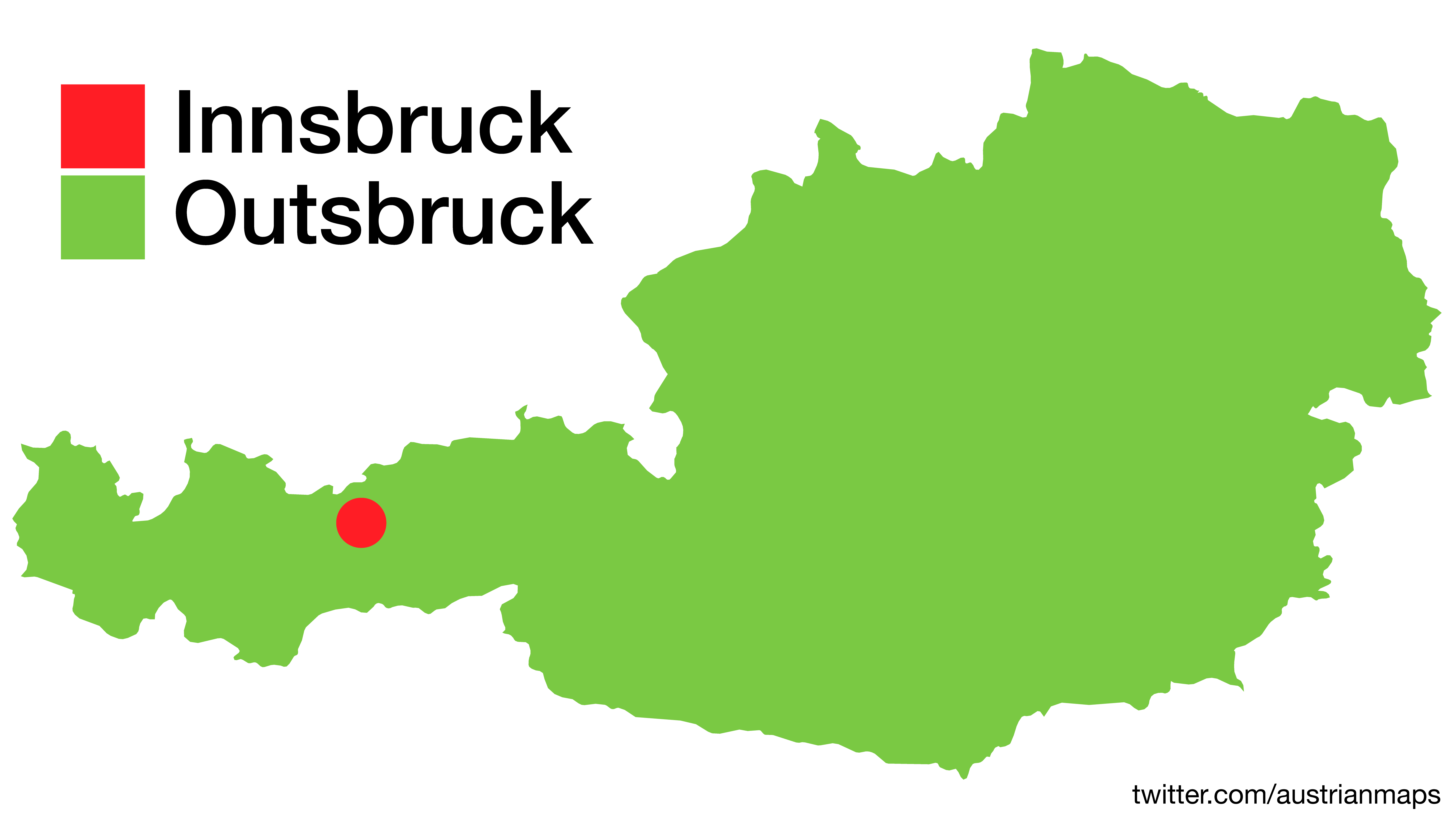
And after these 10 surprising maps, the Alpine republic will never look the same again.

TreeTalk finds rare arboreal treasures among London’s common foliage.
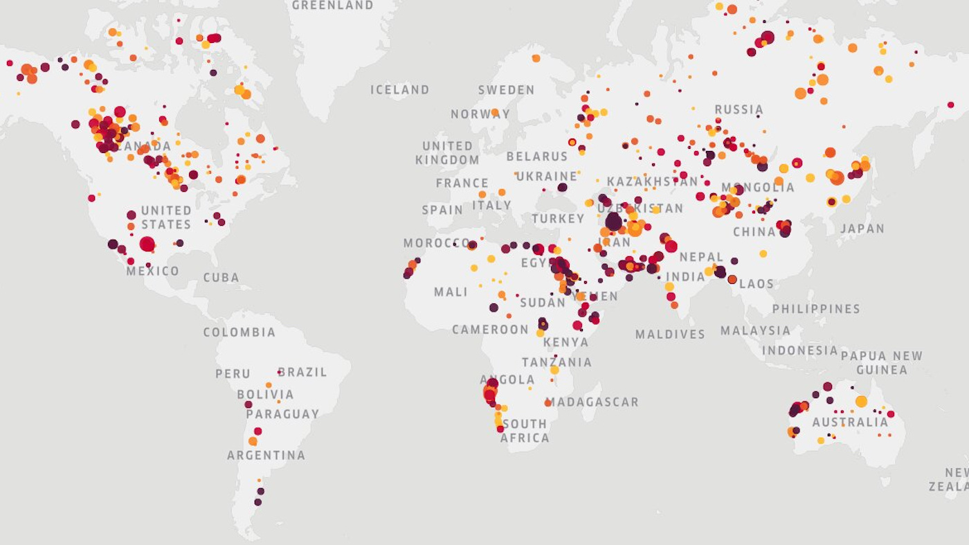
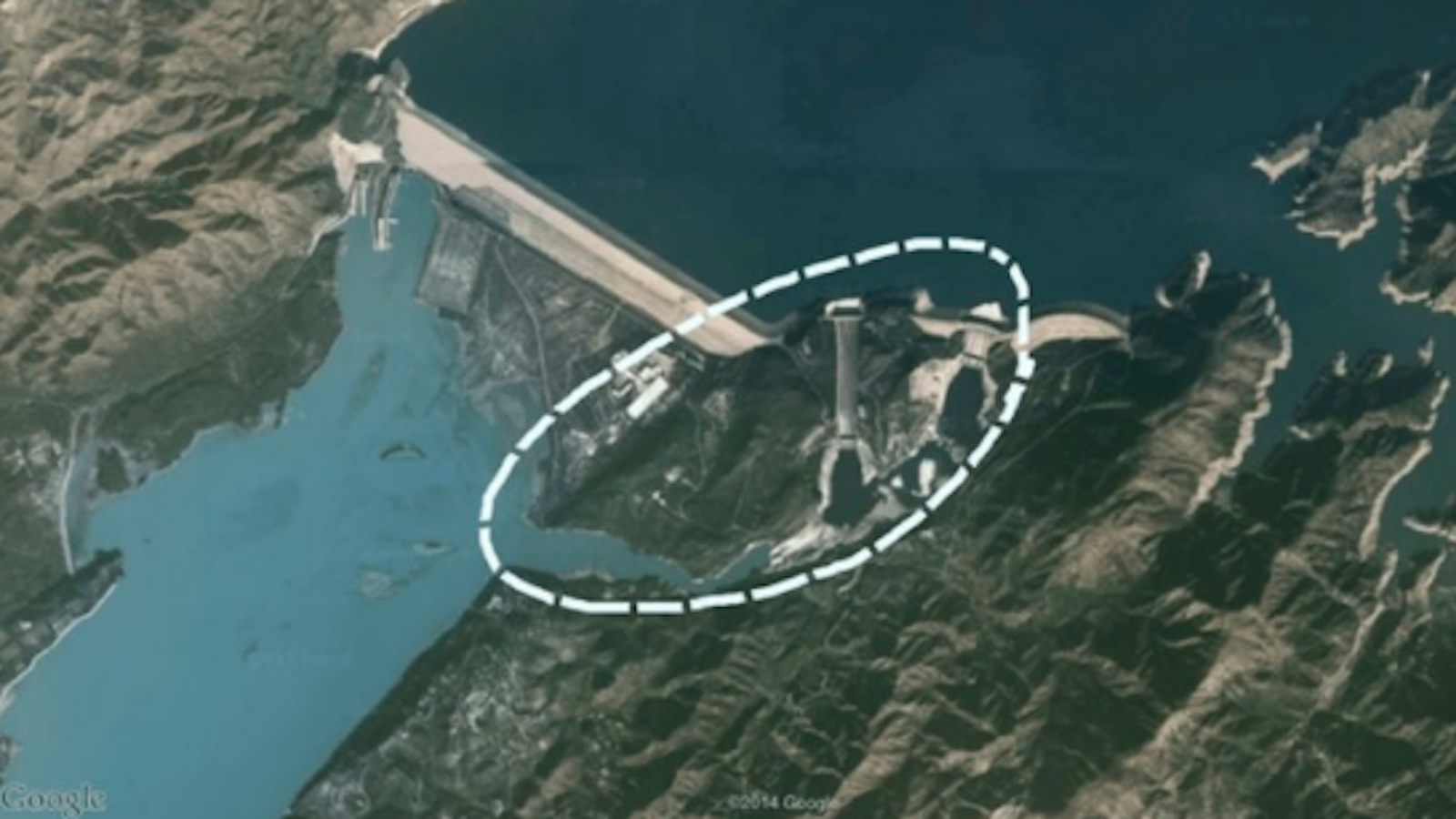
A European start-up uses satellite data to pinpoint individual sources of abnormal methane concentration.

Across the land, state-driven pacts, partnerships, councils and task forces replace a coordinated federal response.
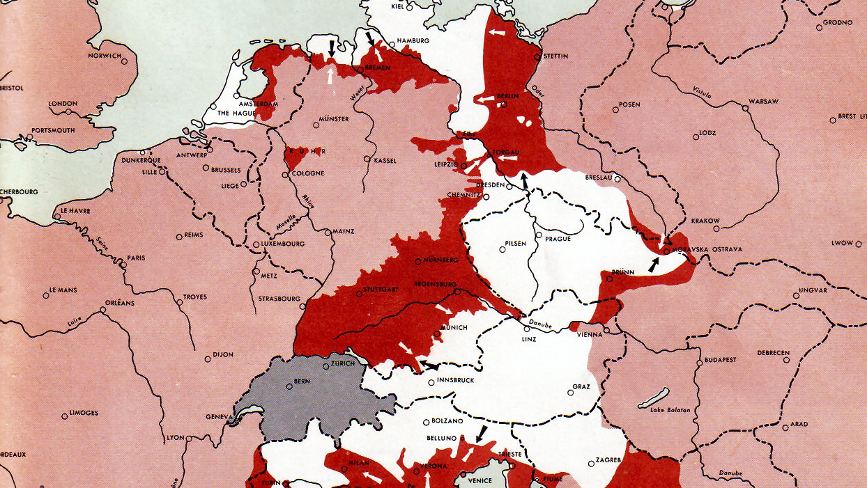
U.S. Army maps show how Western and Eastern Fronts met by May 1, 1945.
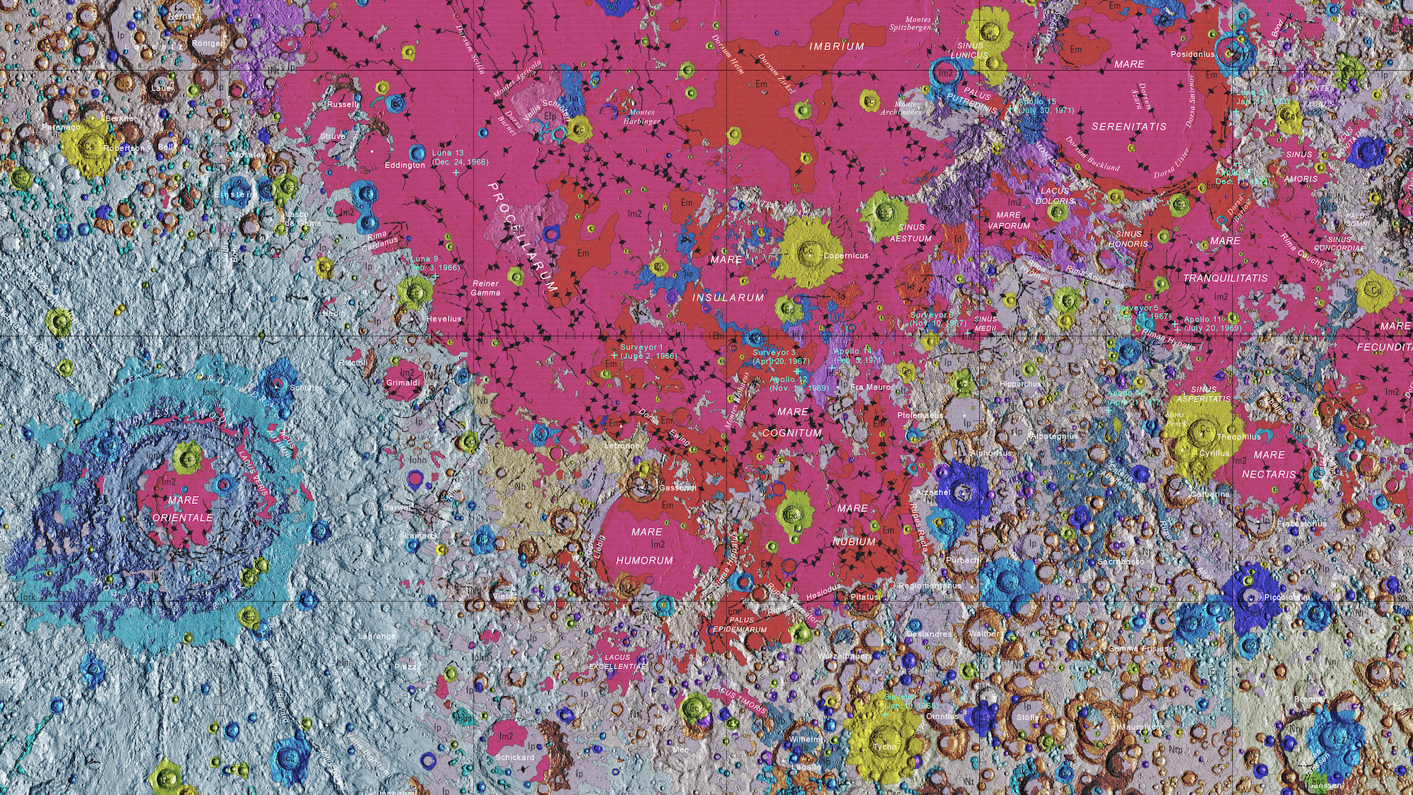
USGS’s ‘Unified Geologic Map of the Moon’ is the definitive blueprint of the lunar surface.
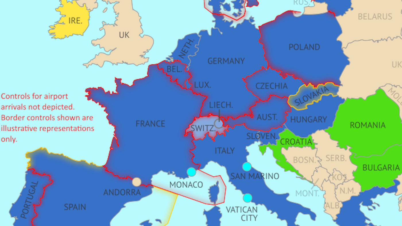
Europe’s border closures due to coronavirus go against a fundamental freedom enshrined in the Schengen Agreement.
The Data Atlas of the World specialises in simple yet revealing maps of the world.
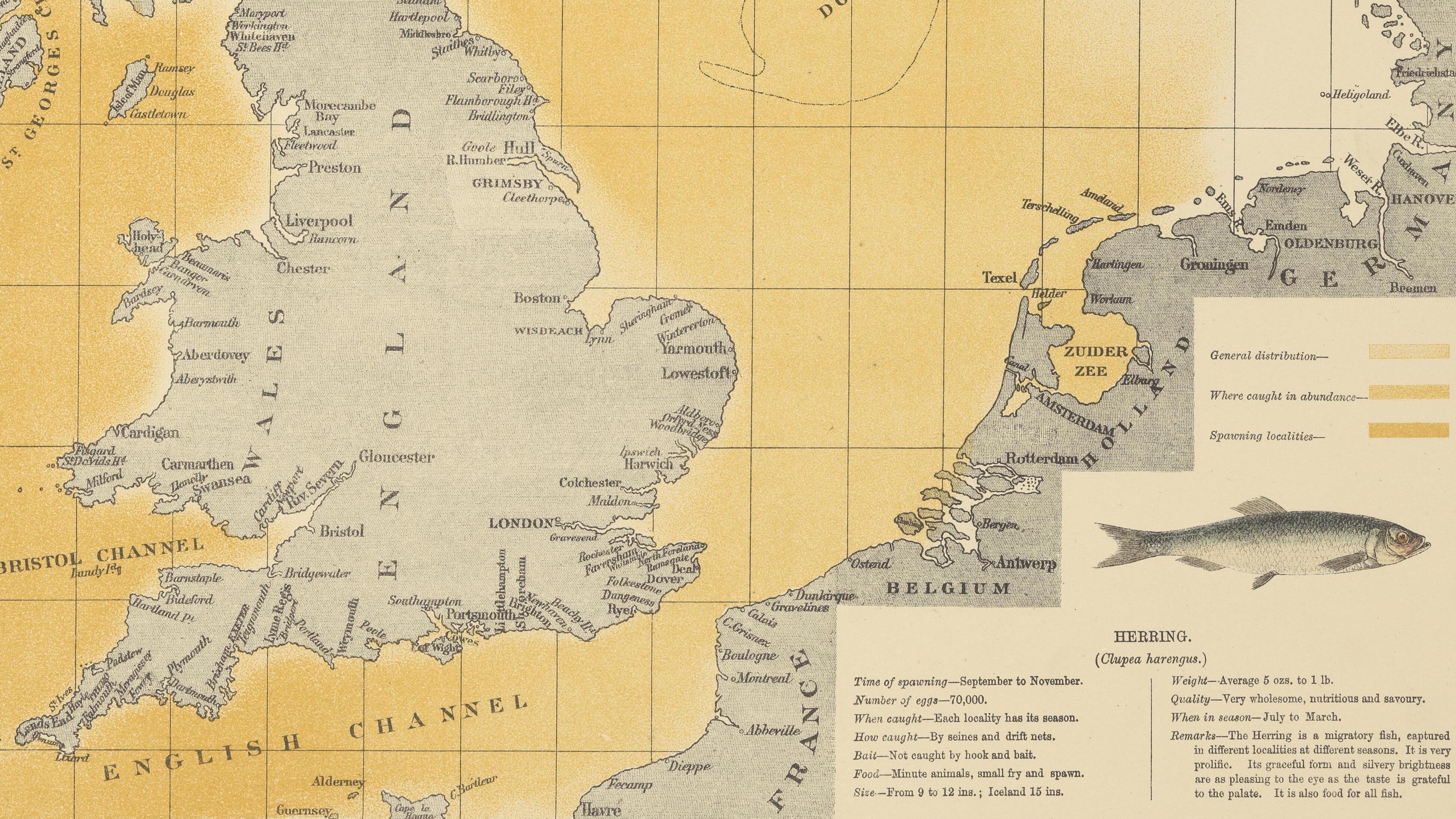
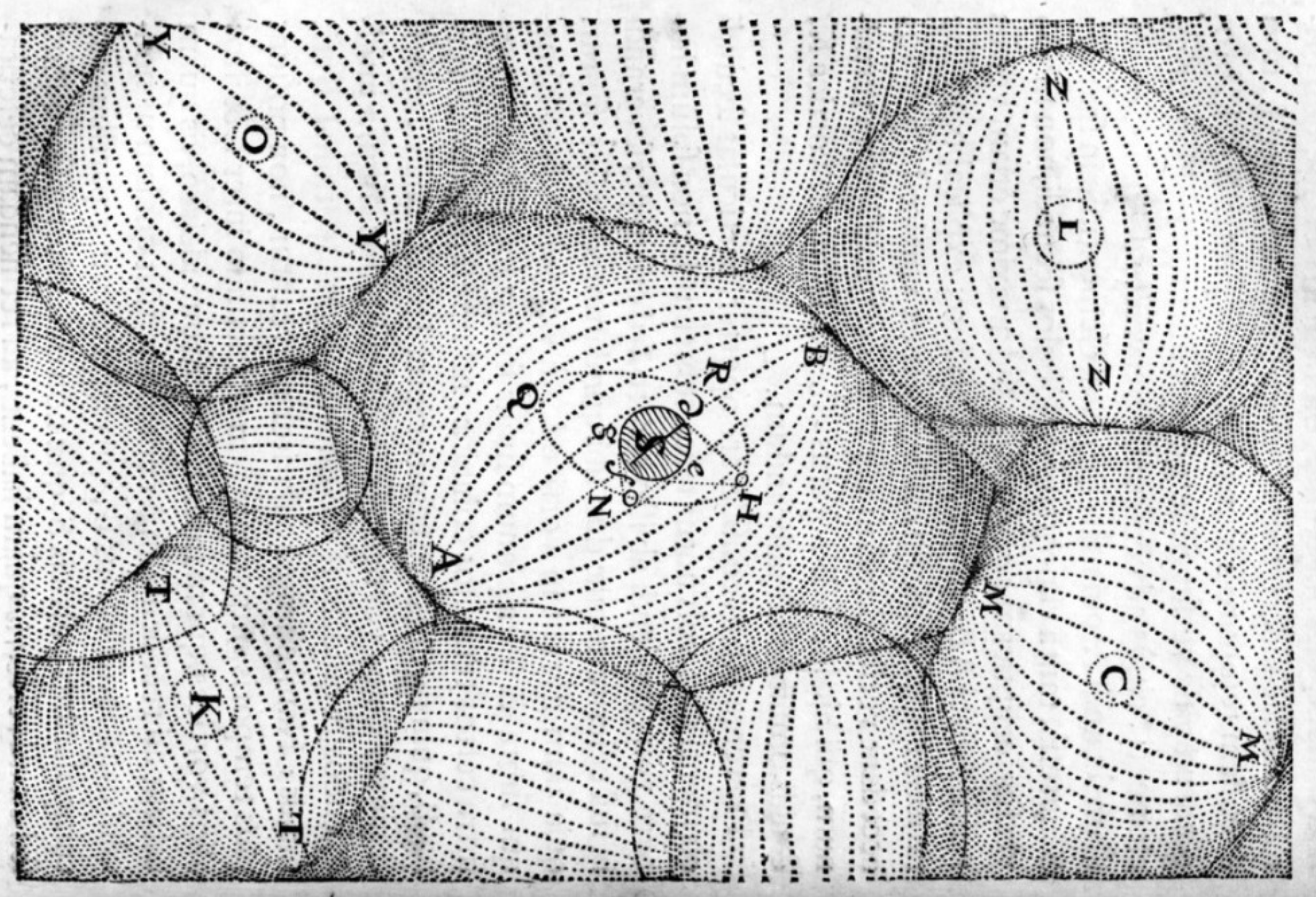
O.T. Olsen’s gorgeous ‘Piscatorial Atlas’ (1883) describes a world now destroyed and forgotten
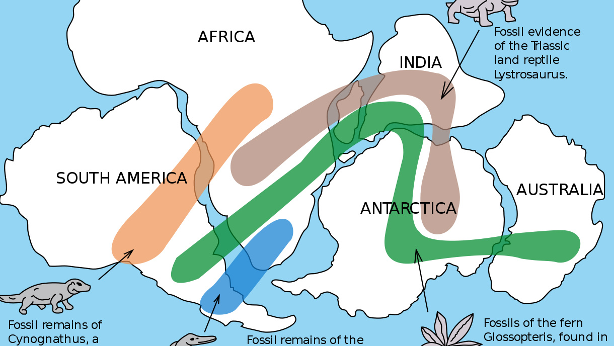
From the mid-19th century, fossils were used as evidence for continental drift – but mainstream scientists didn’t buy it until the 1950s.
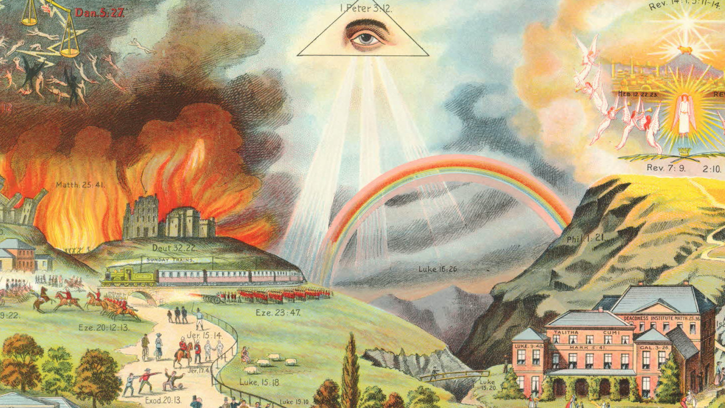
‘The Broad and Narrow Way’ helped 19th-century preachers explain the consequences of virtue and vice.
Coke, meth, ecstasy, amphetamines: each drug has a different ‘capital’
One silver lining of the pandemic: The value of common sense, facts and rational decisions increases.