Strange Maps
A special series by Frank Jacobs.
Frank has been writing about strange maps since 2006, published a book on the subject in 2009 and joined Big Think in 2010. Readers send in new material daily, and he keeps bumping in to cartography that is delightfully obscure, amazingly beautiful, shockingly partisan, and more. "Each map tells a story, but the stories told by your standard atlas for school or reference are limited and literal: they show only the most practical side of the world, its geography and its political divisions. Strange Maps aims to collect and comment on maps that do everything but that - maps that show the world from a different angle."
featured


All Stories
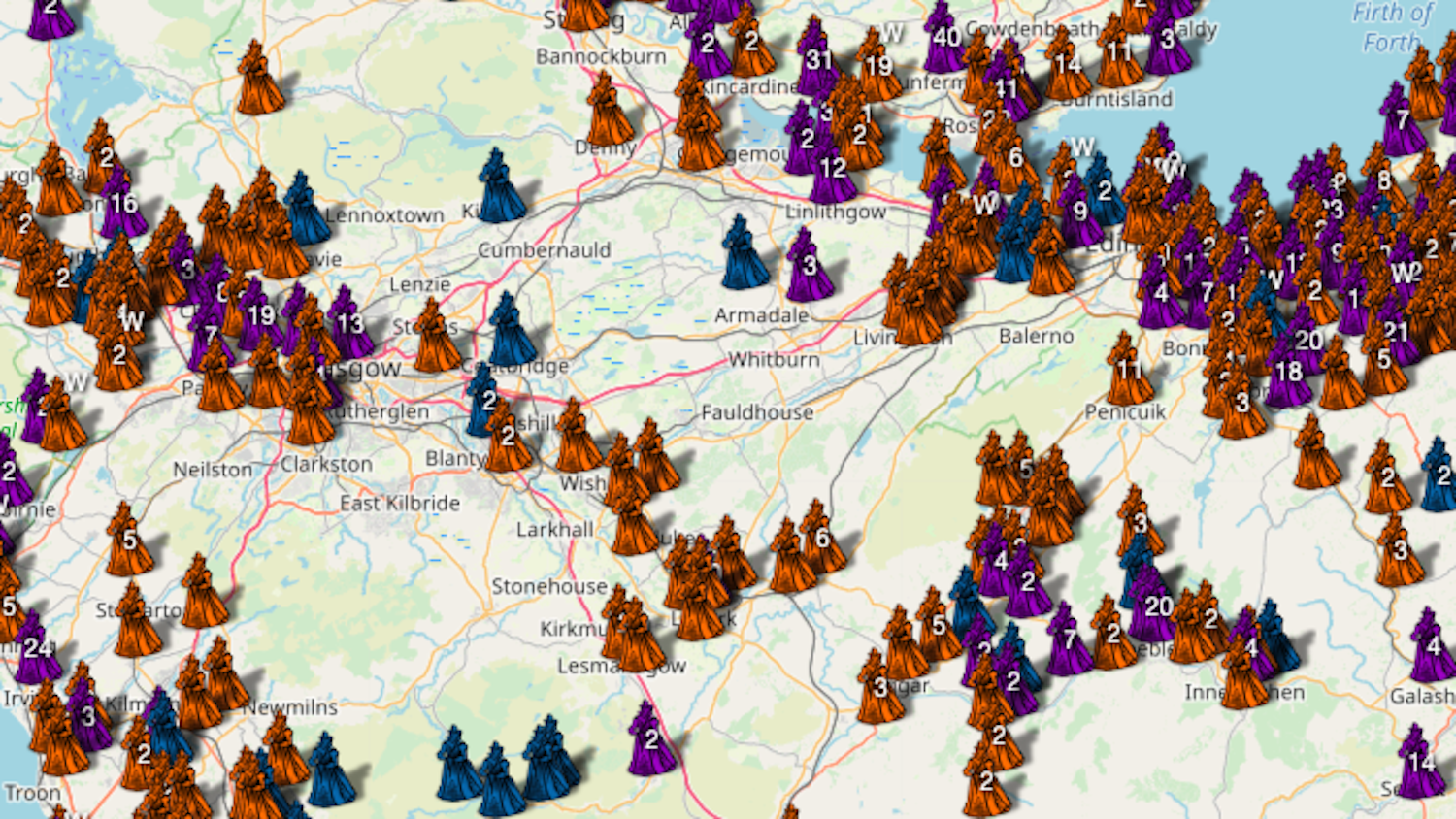
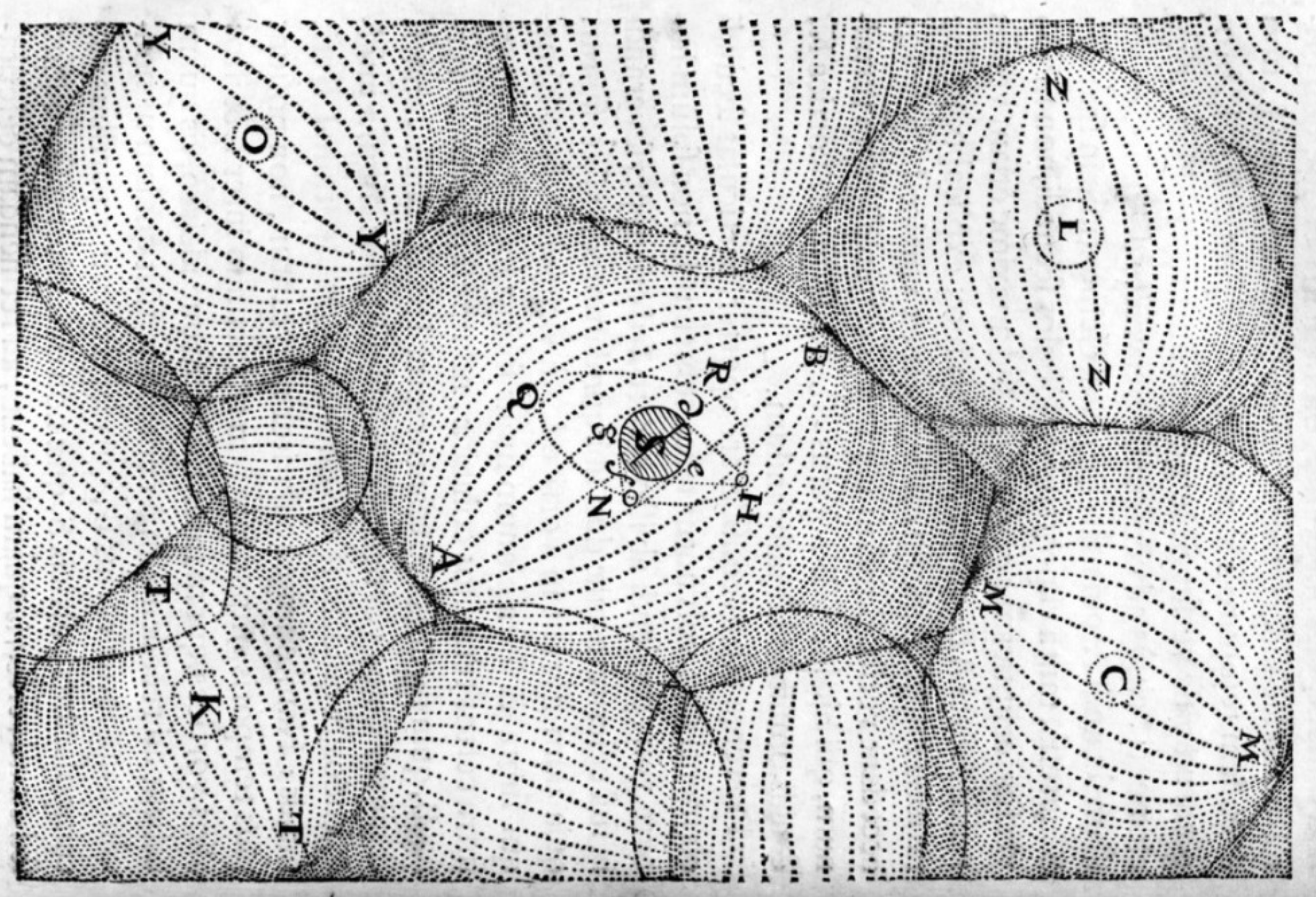
Edinburgh University project geo-locates victims of Scottish ‘witch-prickers’ in the 16th and 17th century.
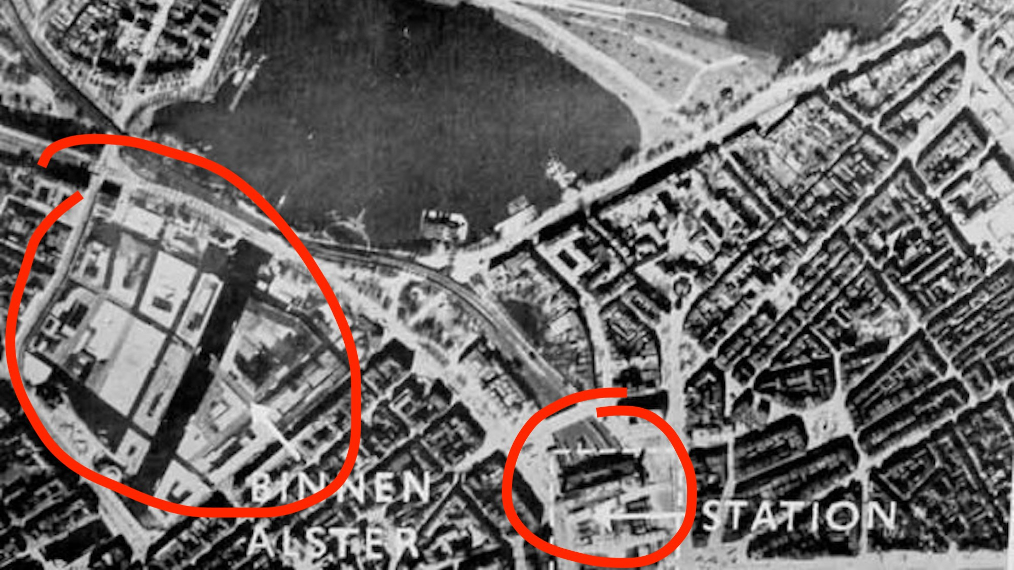
‘Operation Invisibility Cloak’ was a waste: Hamburg would soon be firebombed to bits
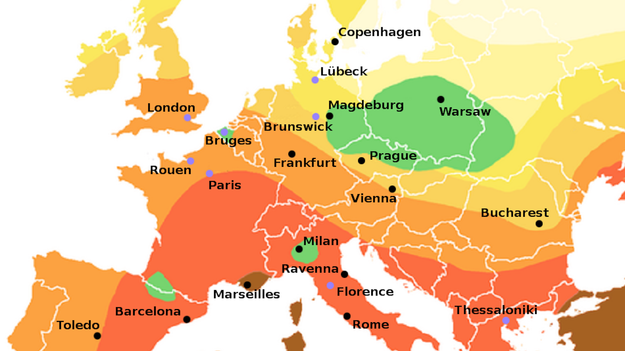
The Black Death skipped certain parts of Europe – and that could be a lesson for today’s coronavirus epidemic
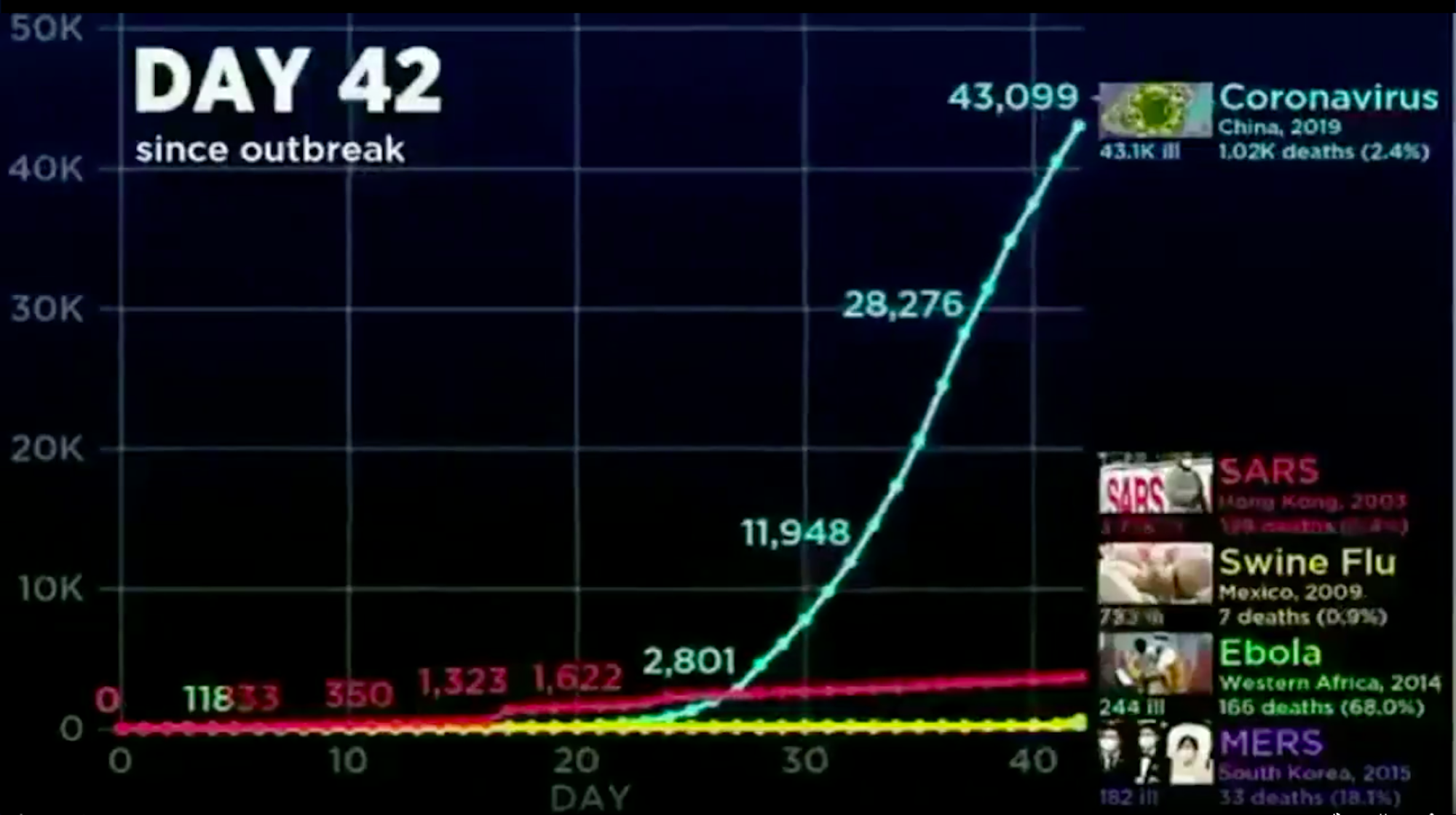
The video fragment only shows increase in COVID-19 cases, reversing the video’s original message to induce panic.
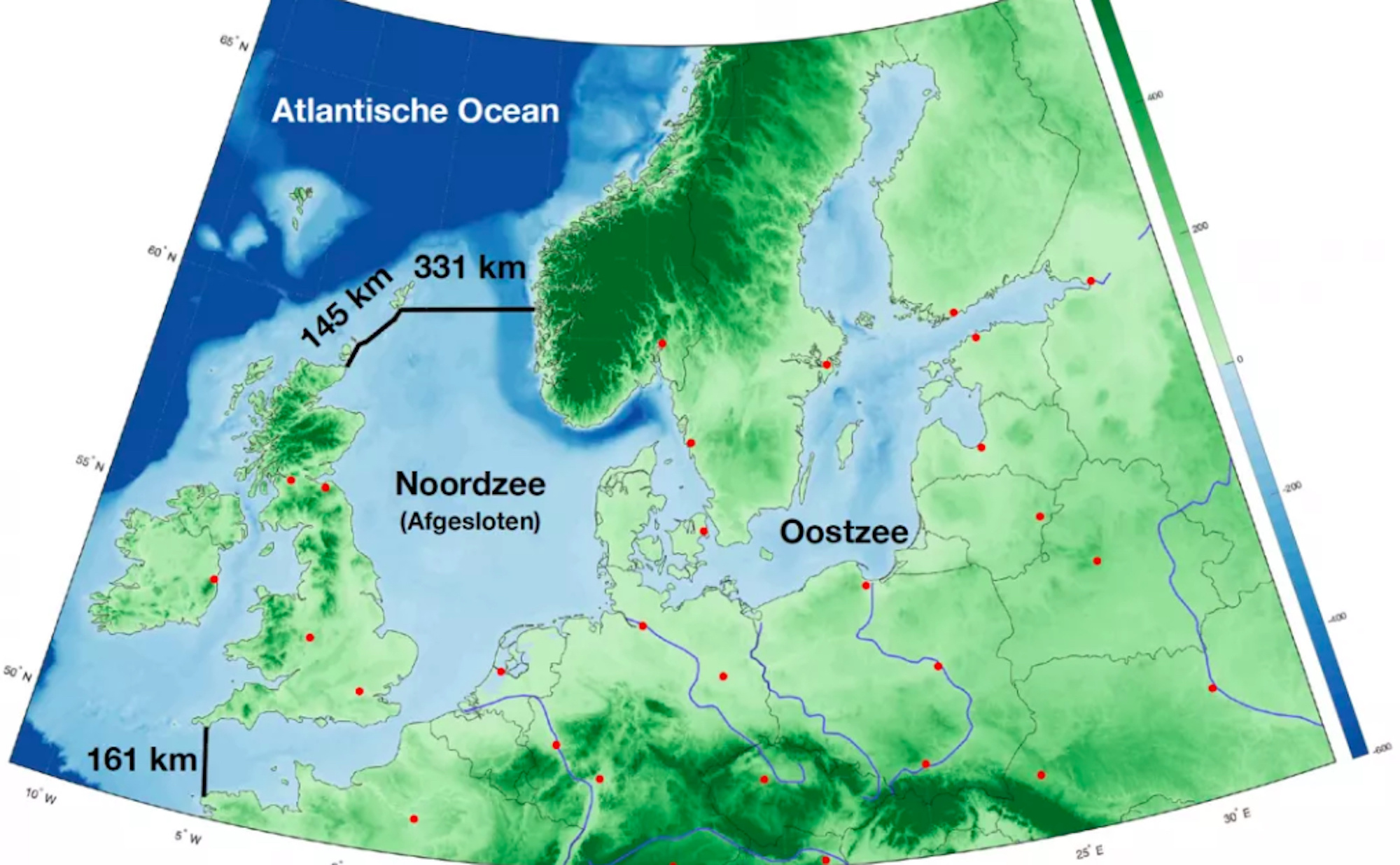
Why a 400-mile enclosure around the North Sea is not as crazy as it sounds
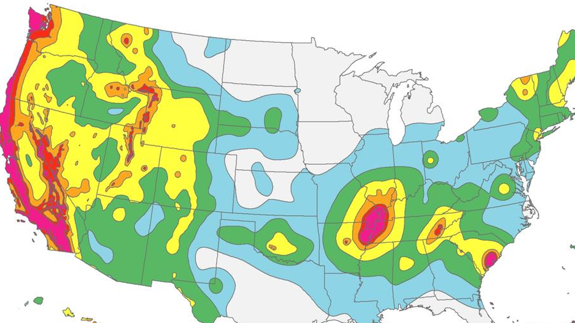
Minnesota earned its ‘blue mark’ in the 1975 Morris earthquake, which had its epicenter in the western part of the state.
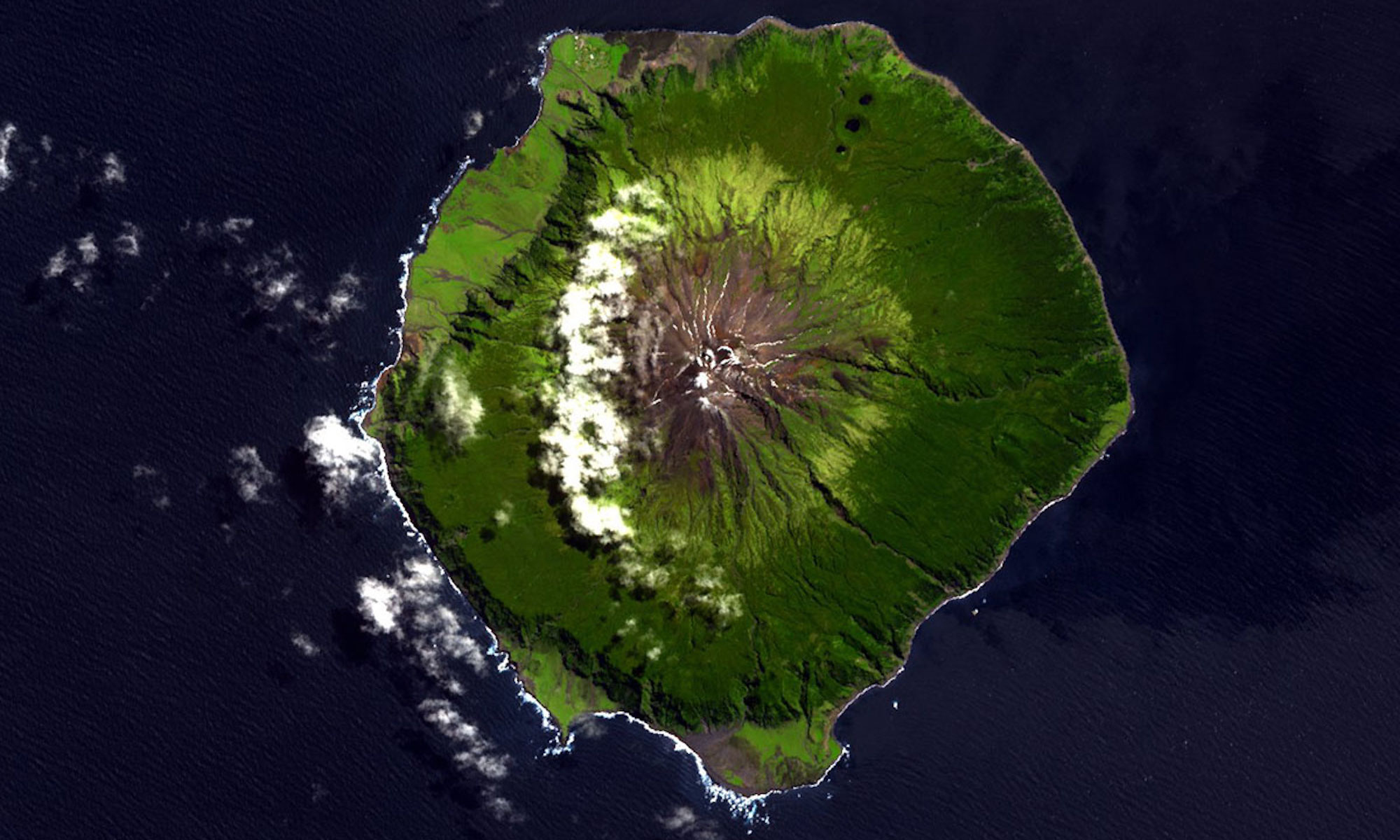
The world’s most isolated inhabited island also has some of the world’s strangest toponyms.
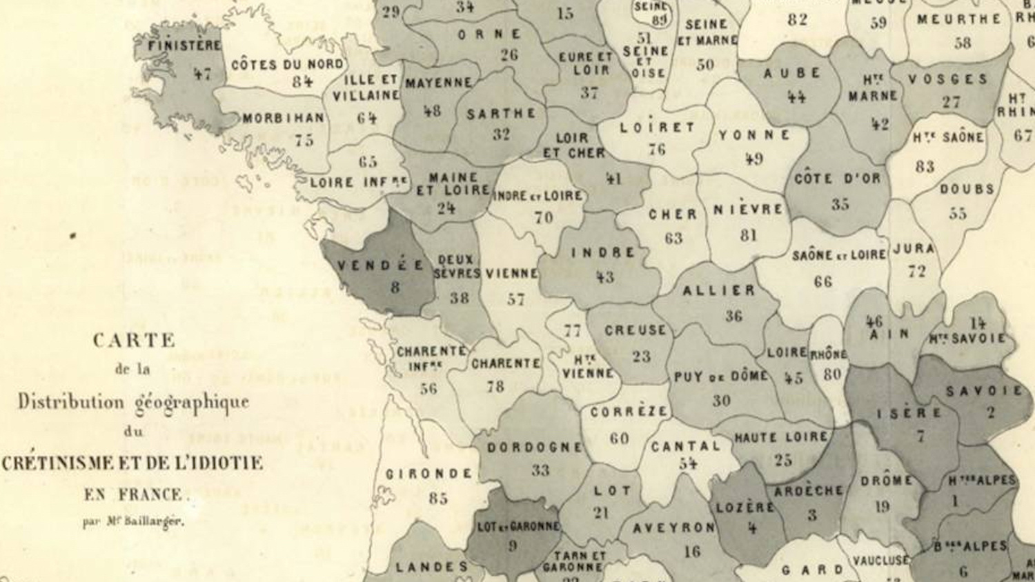
Now an insult, ‘cretin’ was the medical term for a debilitating disease endemic in the Alps until the early 20th century.
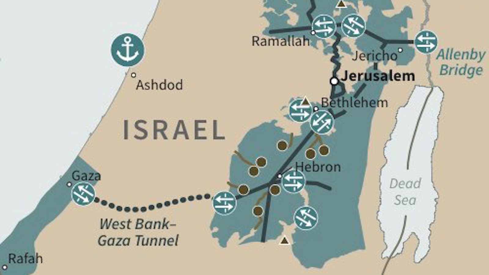
Trump’s Middle East peace plan contains the first map of a Palestinian state that ‘Israel can live with’.
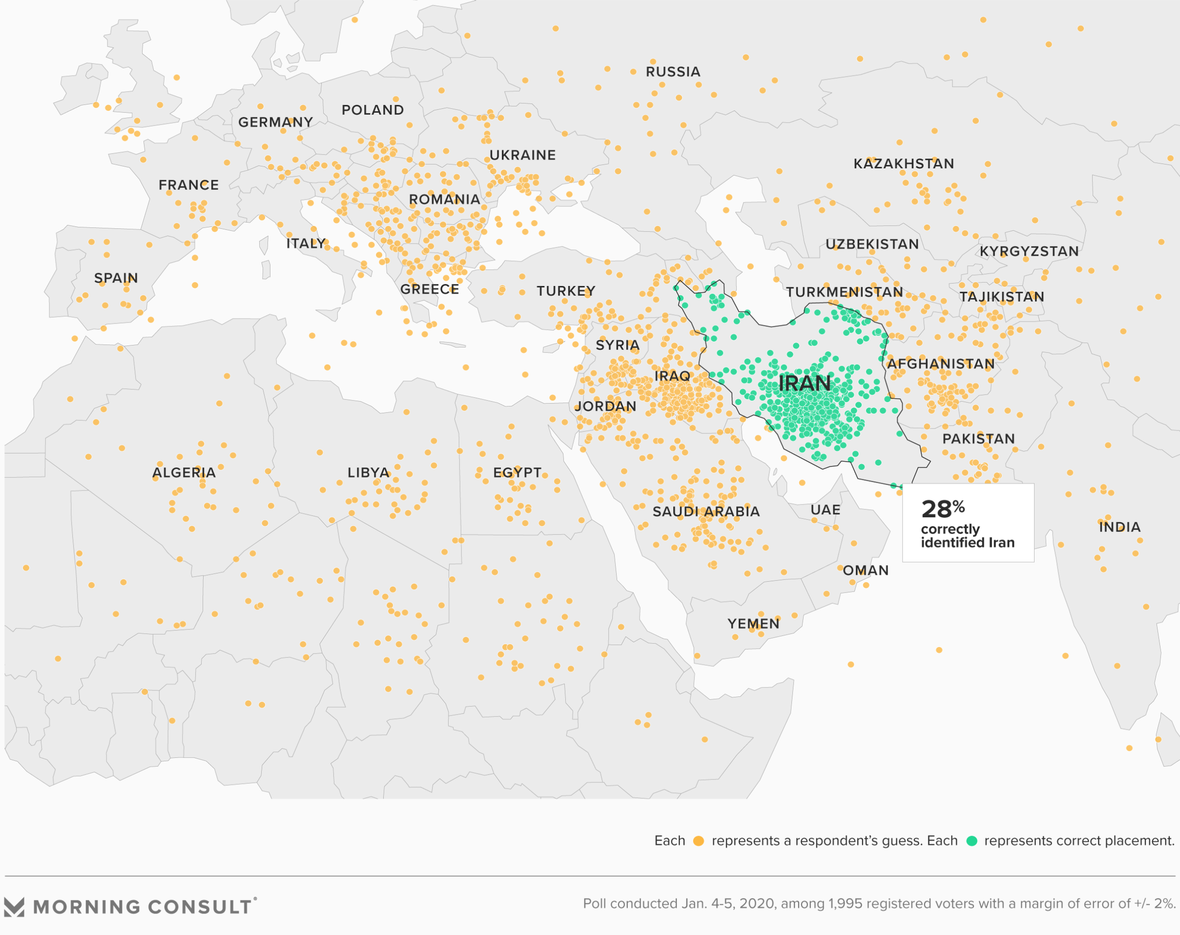
Invented in 1902 by an American, the ‘Middle East’ is all over the place.
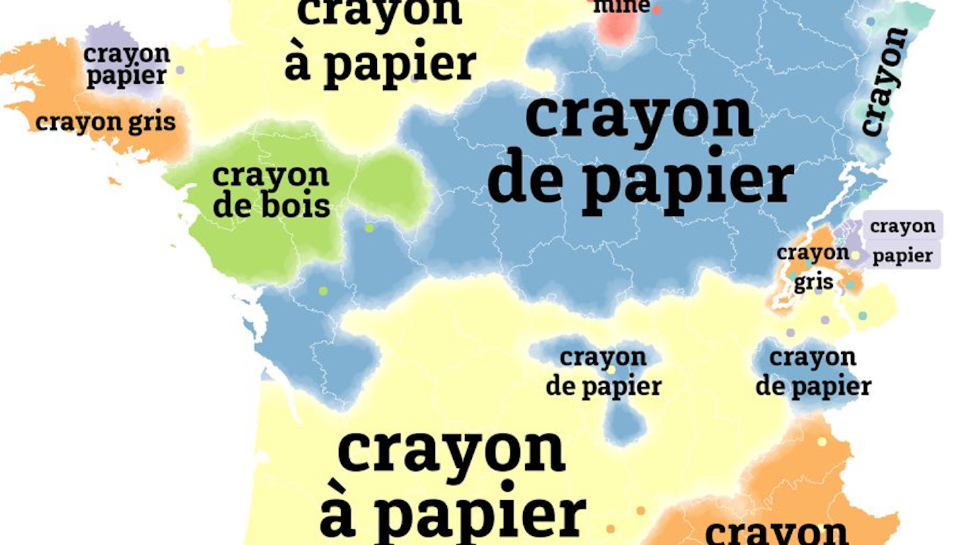
Isogloss cartography shows diversity, richness, and humour of the French language
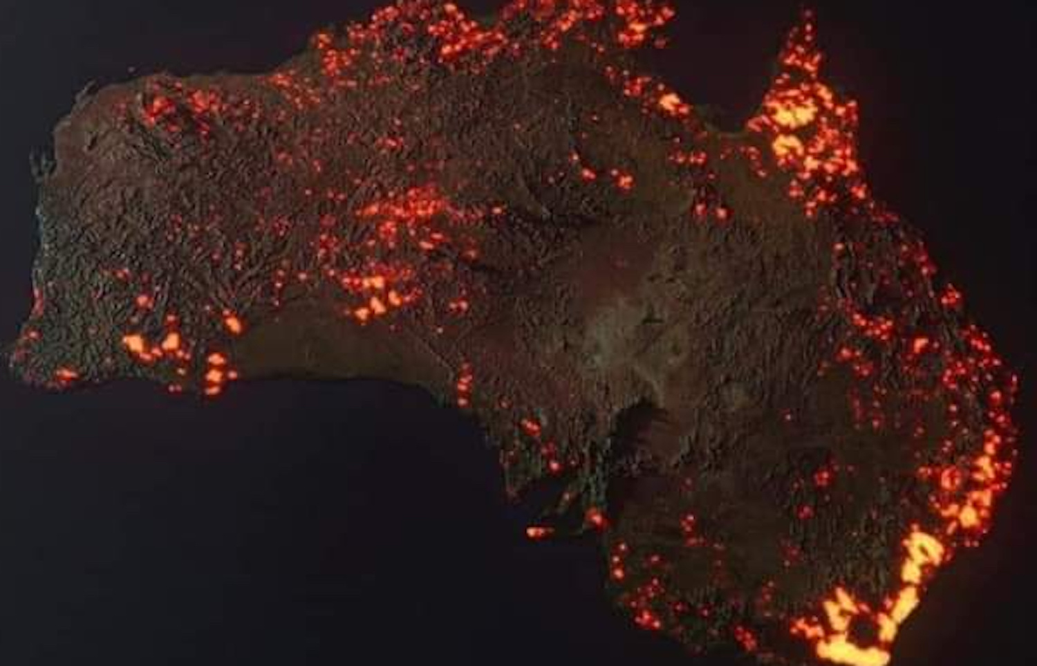
Viral ‘photo’ is composite image, but other map shows true and growing size of devastation
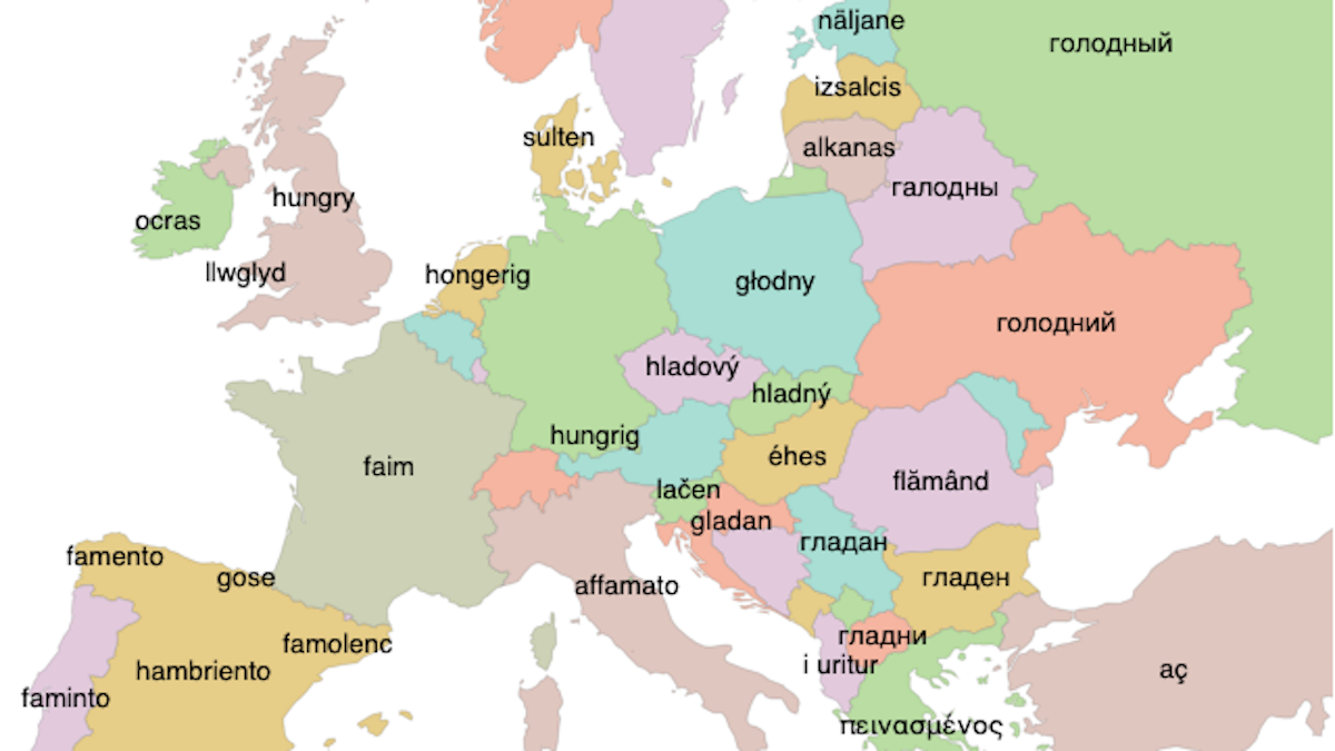
European Word Translator: a simple idea adds a cartographic flourish to Google’s online translation service
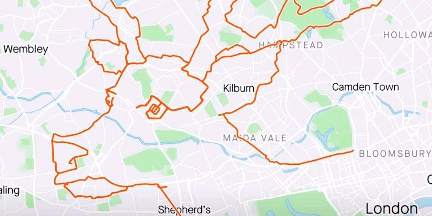
Giant Christmas image took 80 miles and nine hours to make
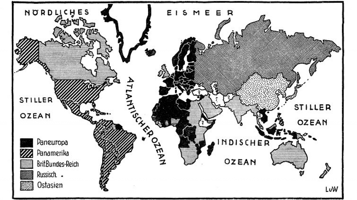
Austro-Japanese aristocrat Richard von Coudenhove-Kalergi later concentrated on plans for Pan-Europe.
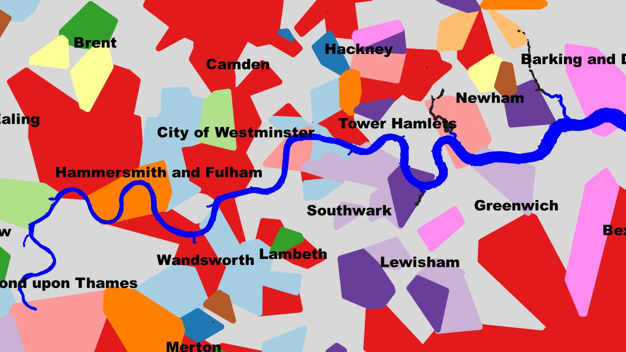
The British capital’s love affair with buckets and nuggets, explained
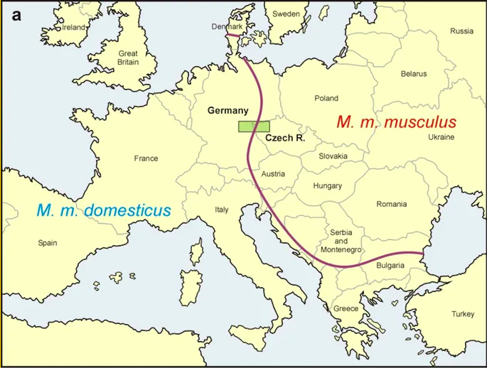
Two house mouse subspecies meet again in a hybrid zone strangely reminiscent of the Iron Curtain

As this map of Bouguer’s gravity anomaly shows, the pull of the earth varies considerably by region.
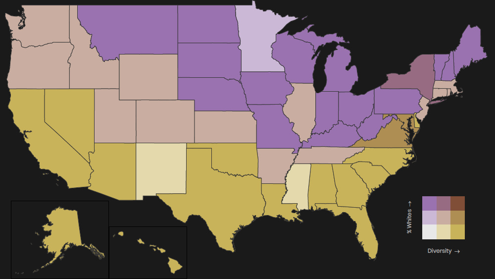
School diversity is less widespread in central and northern states
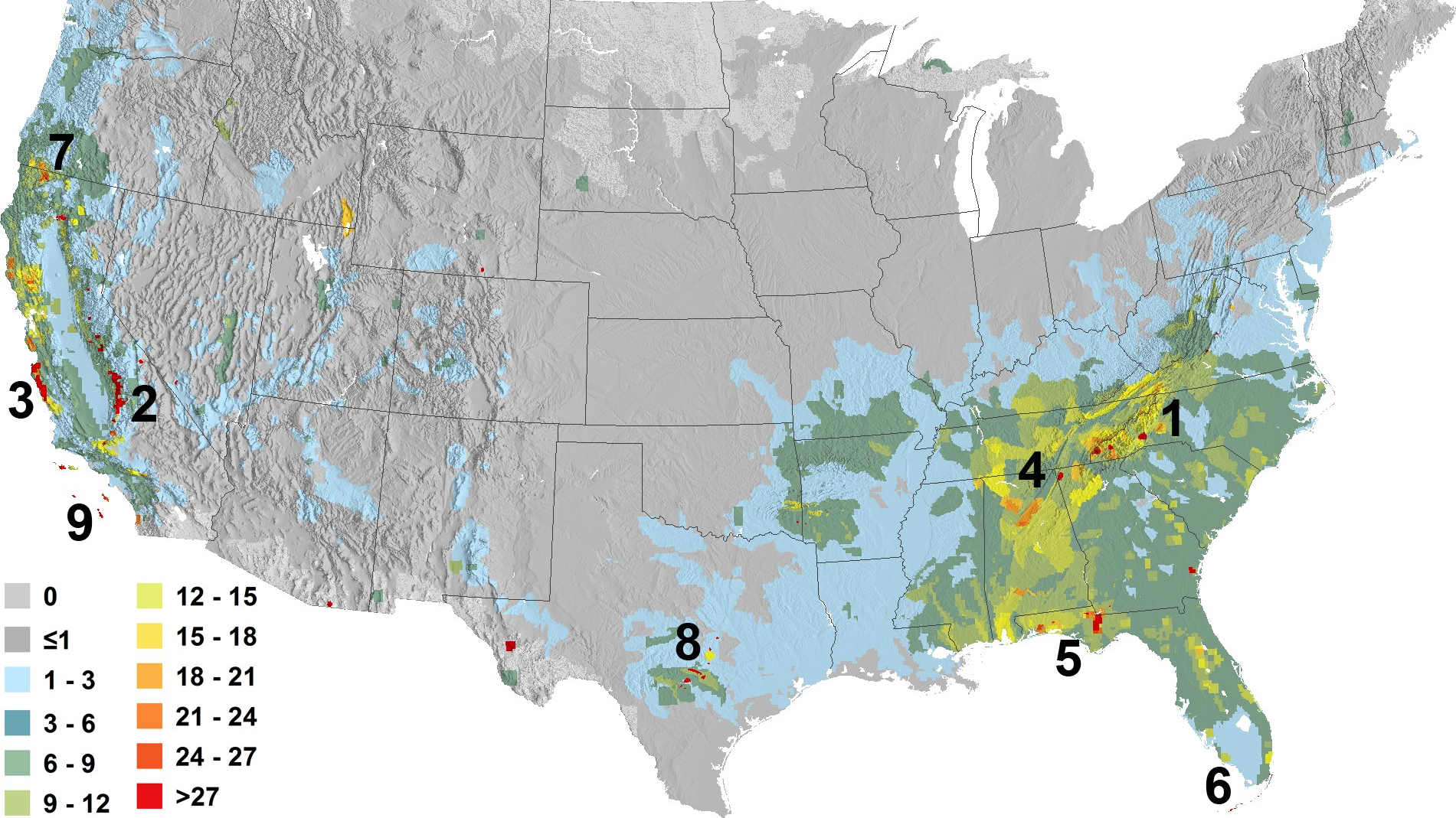
Project to map global ‘species richness’ highlights the variety of biodiversity itself
These maps show surprising juxtapositions of ancient and modern toponyms of the Mother Continent.
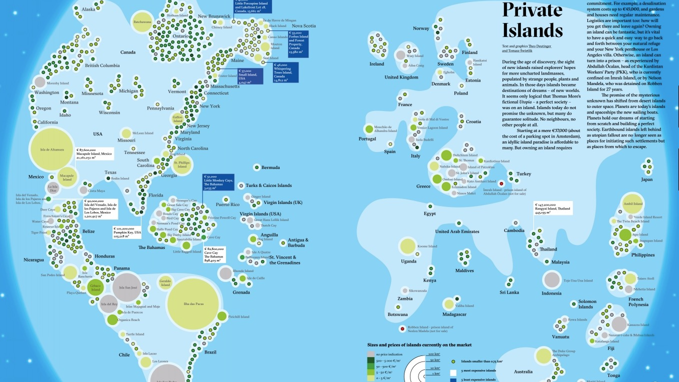
There’s something special about islands – in some cases, it’s the price tag
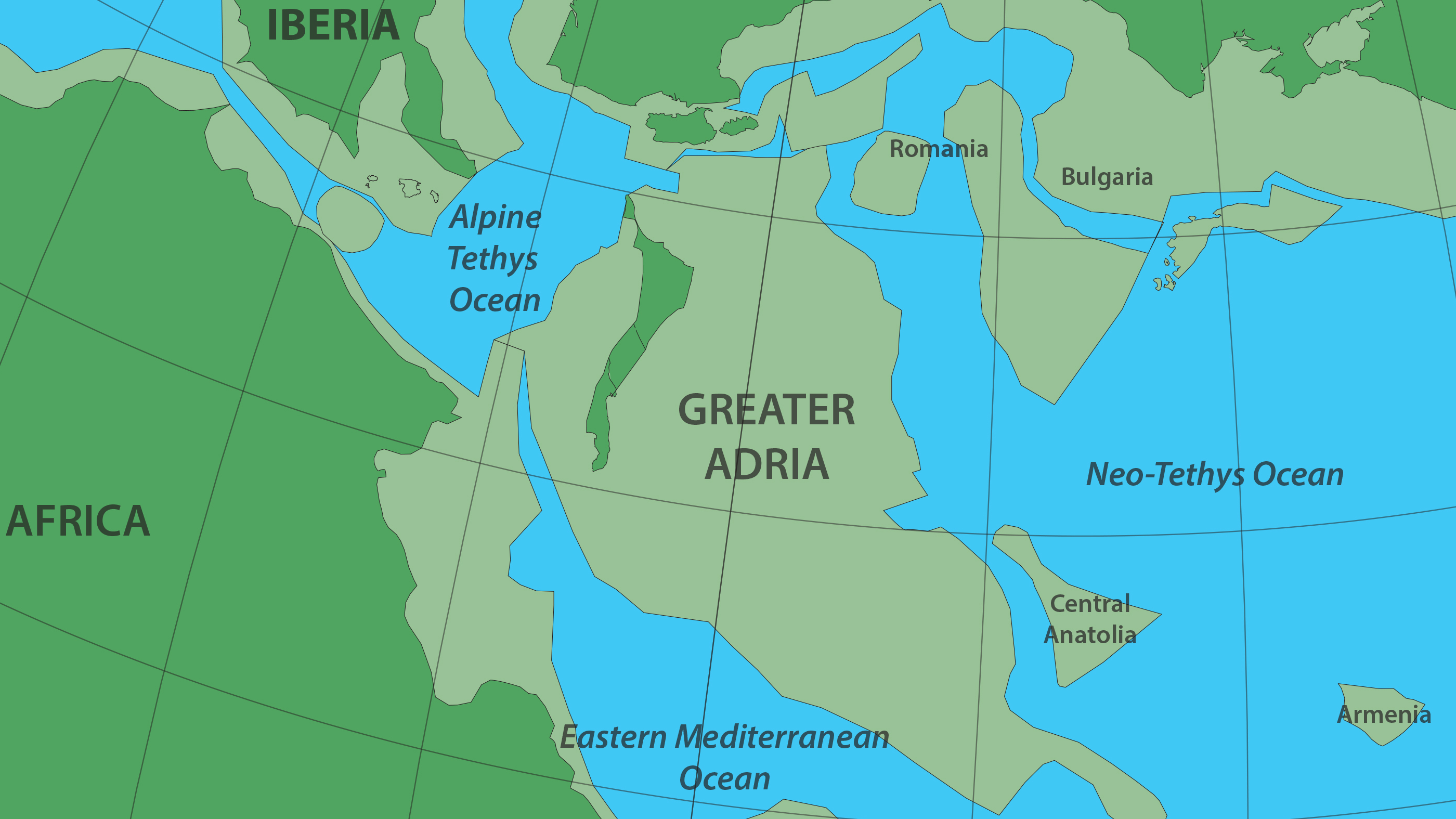
Most of it was eaten by Earth’s mantle, but scraped-off bits survive in the Alps and other mountain ranges.
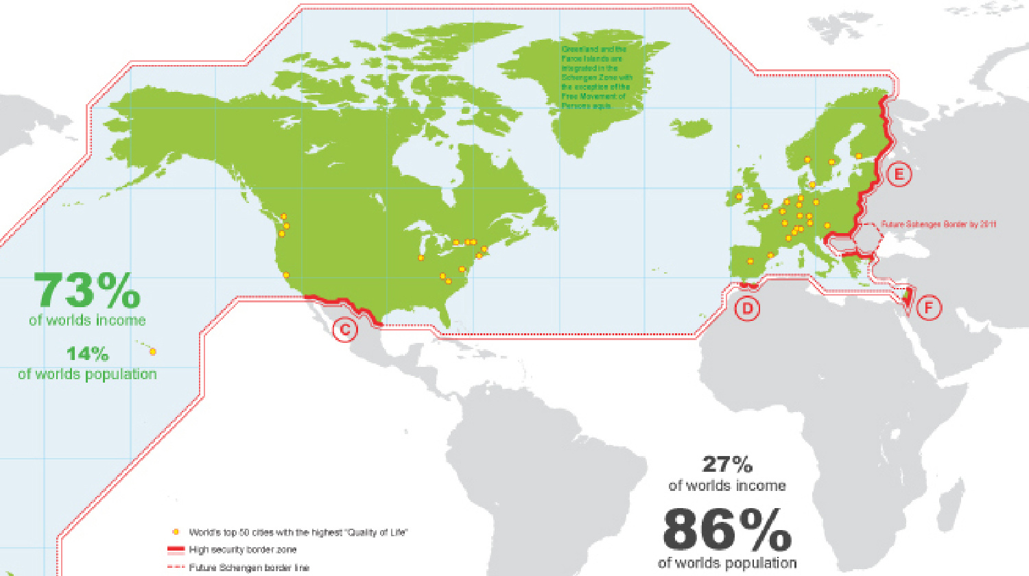
A review of the global “wall” that divides rich from poor.
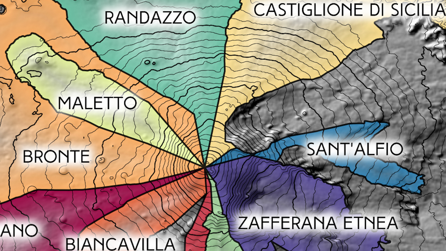
The summit of Europe’s most active volcano is also the world’s only decipoint.
“Brasilia, the biggest paper town ever.”
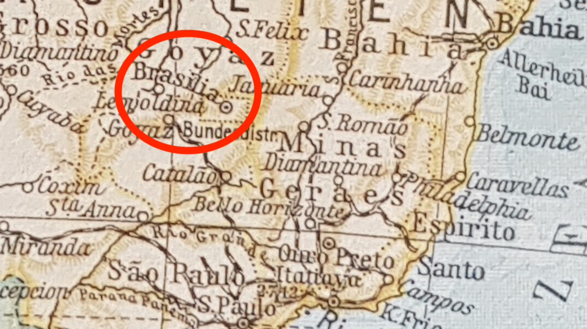
Forensic cartography 101: Explain what Brasilia is doing on this map of 1920s South America.
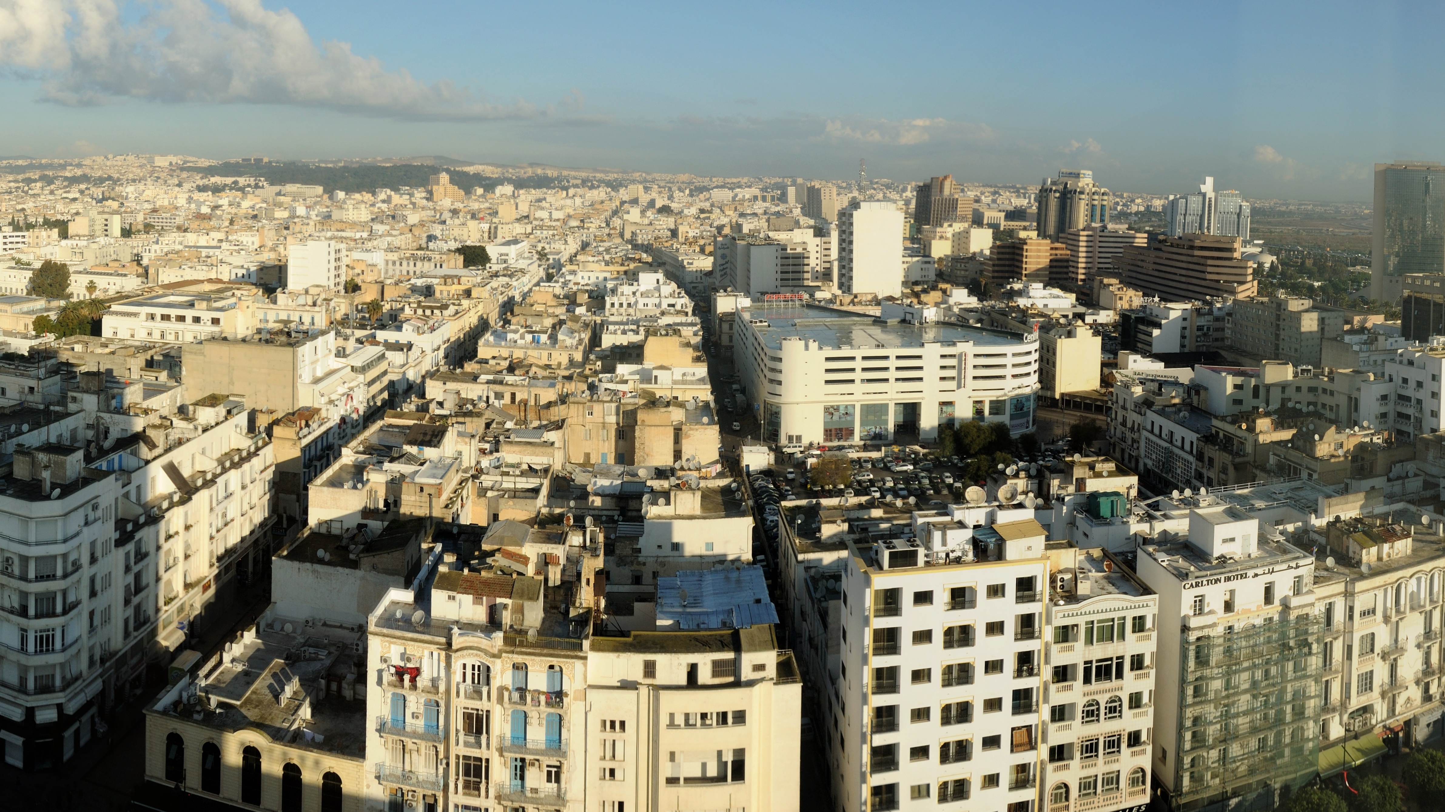
How the half-hour commute and motorised transport changed our cities into huge metropolises.
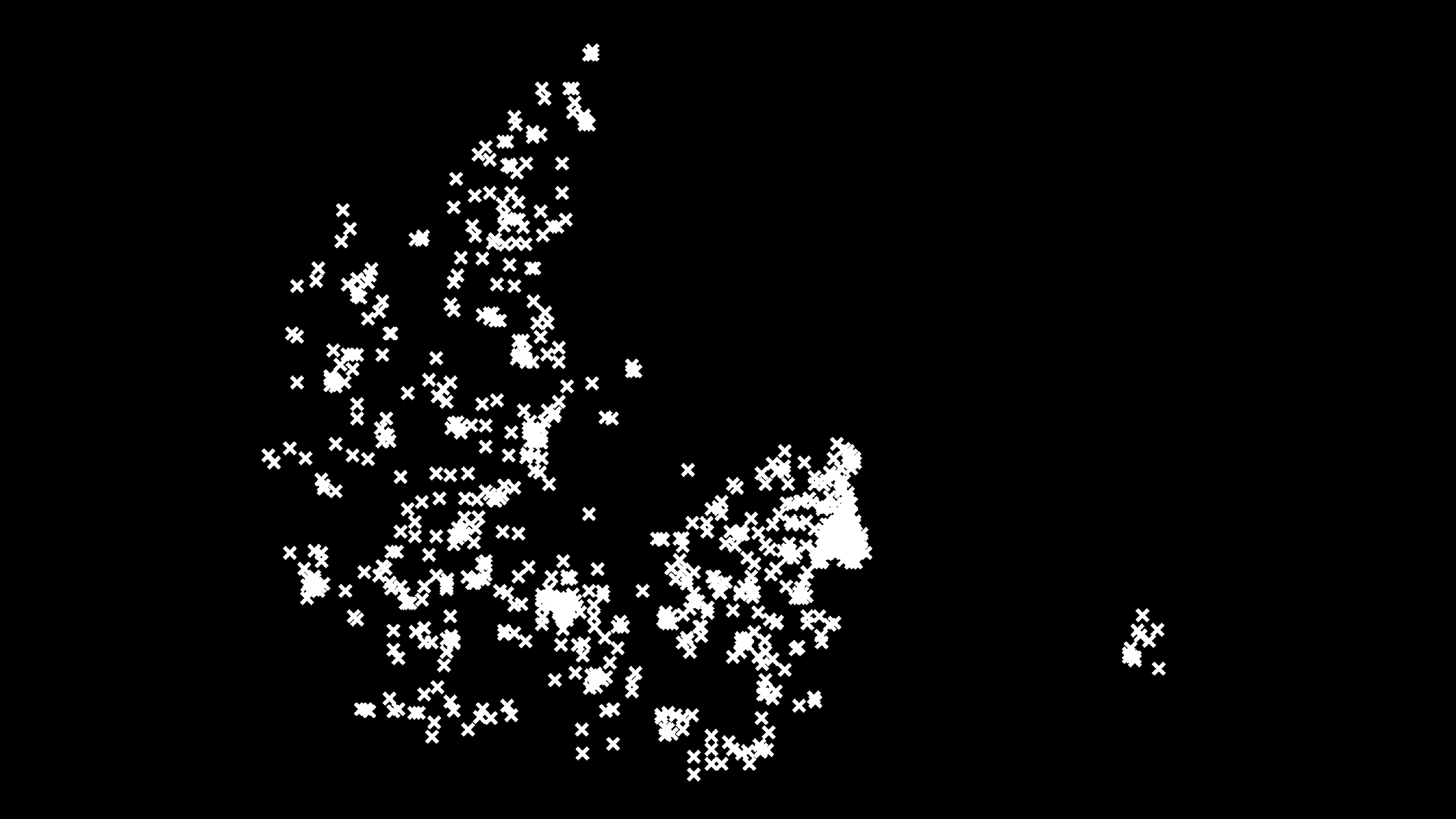
Lovers deadlier than gangsters, first comprehensive Danish homicide study since 1970s shows
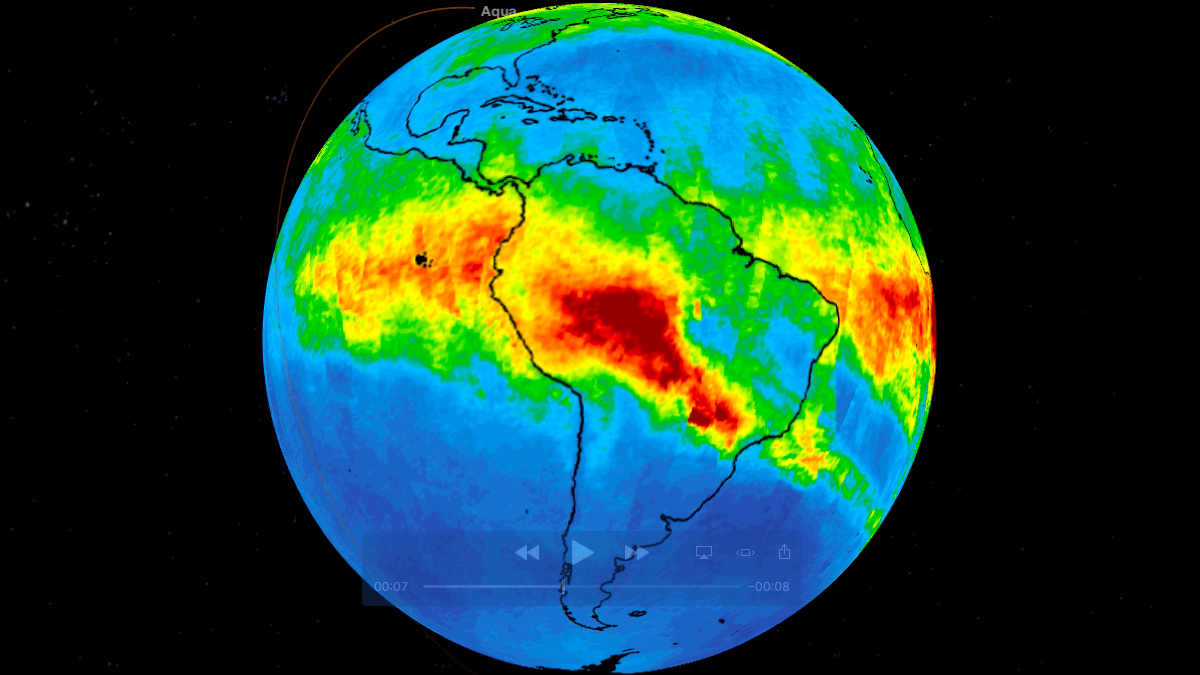
Satellite movie shows clouds of carbon monoxide drifting over South America.